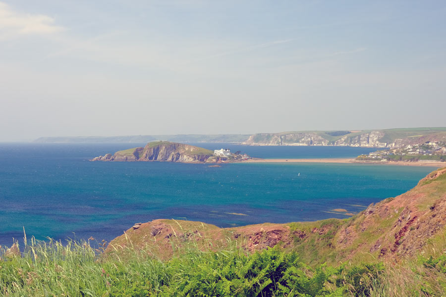
The most popular way of walking the whole South West Coast Path is from Minehead to South Haven Point. This page is about walking it in the opposite direction as far as Plymouth. There is a Reverse Guide published by the South West Coast Path Association. I have also added a section about walking the coastal path in Dorset that is immediately before walking it in this direction.
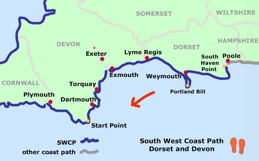
Hampshire to South Haven Point
South West Coast Path:
South Haven Point to Lyme Regis
Lyme Regis to Plymouth
The Dorset coastal path Hampshire border to South Haven Point
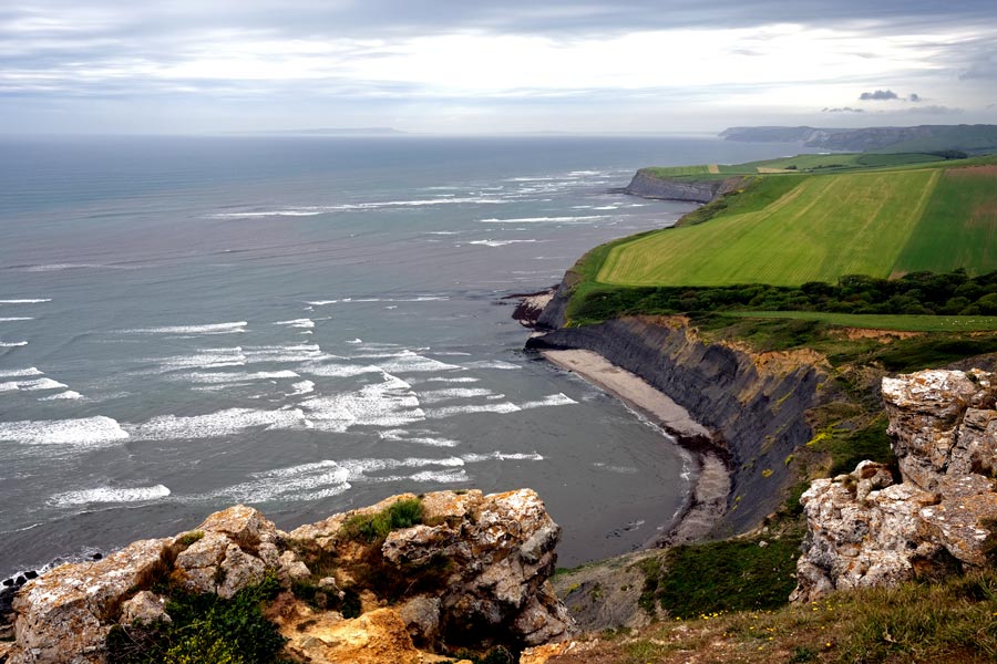
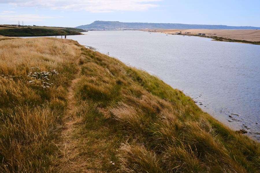
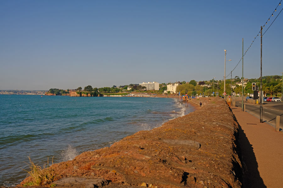
I decided to walk 18 miles of the coastal path from the Hampshire border to the Sandbanks Ferry at South Haven Point as this is the remainder of the Dorset coast that is not covered by the South West Coast Path.
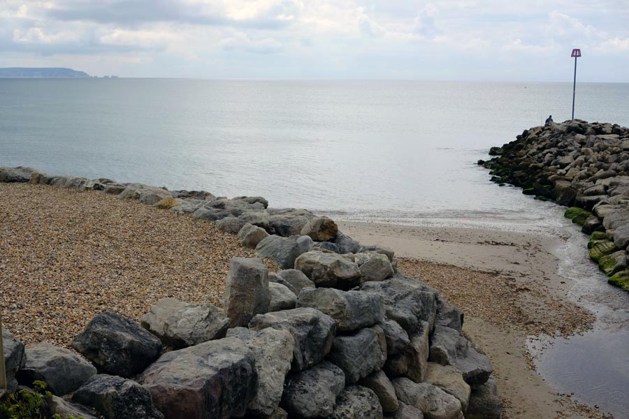
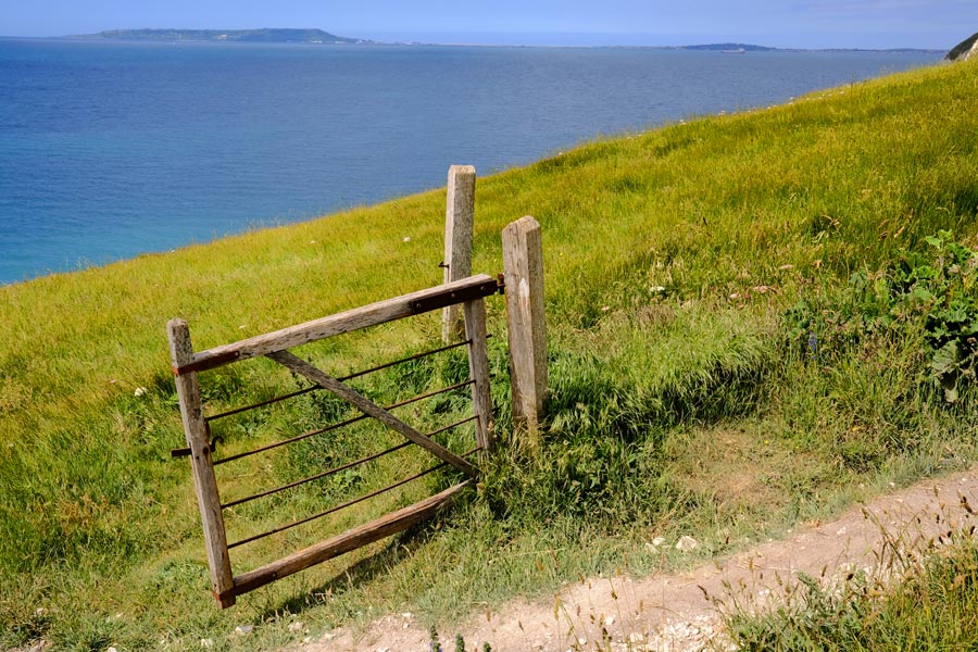
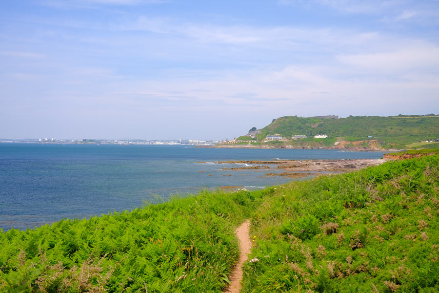
Walkford Brook at Christchurch Bay
entryphoto2
I took a train to Hinton Admiral and walked down to the coast at Chewton Bunny and the Walkford Brook, which is the county border between Hampshire and Dorset. It was overcast but not cold. A fine day for walking. Good weather had been forecast.

Highcliffe Beach
It was a pleasant, easy walk into Highcliffe where the track becomes a promenade - with lots of beach huts.

The Haven House Inn
After more beach huts and a pleasant detour through the wooded grounds of Highcliffe Castle and then more beach huts I arrived at the Haven House Inn where I stopped for refreshment.
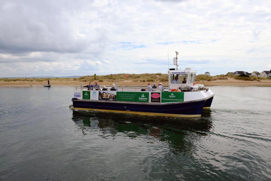
The Ferry to Hengistbury Head
Much refreshed I took the short Ferry ride across the mouth of Christchurch Harbour to Hengistbury Head where I then walked past more beach huts before walking along the edge of the Hengistbury Head Nature Reserve.
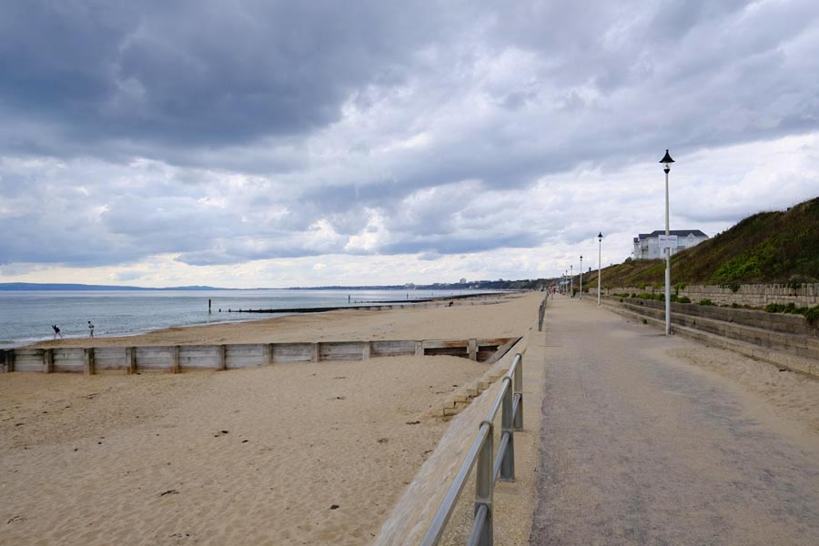
Southbourne Beach
After a walk across the heath, the path joined with the promenade along Southbourne Beach.
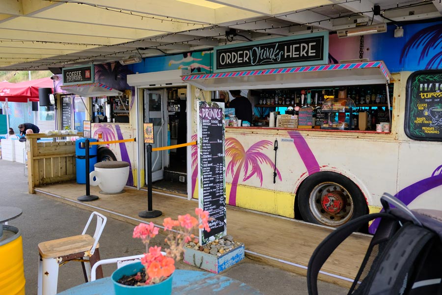
Bar Bus
Some way along near Boscombe I stopped to rest my feet and refresh myself at this colourful establishment centred around a old bus.
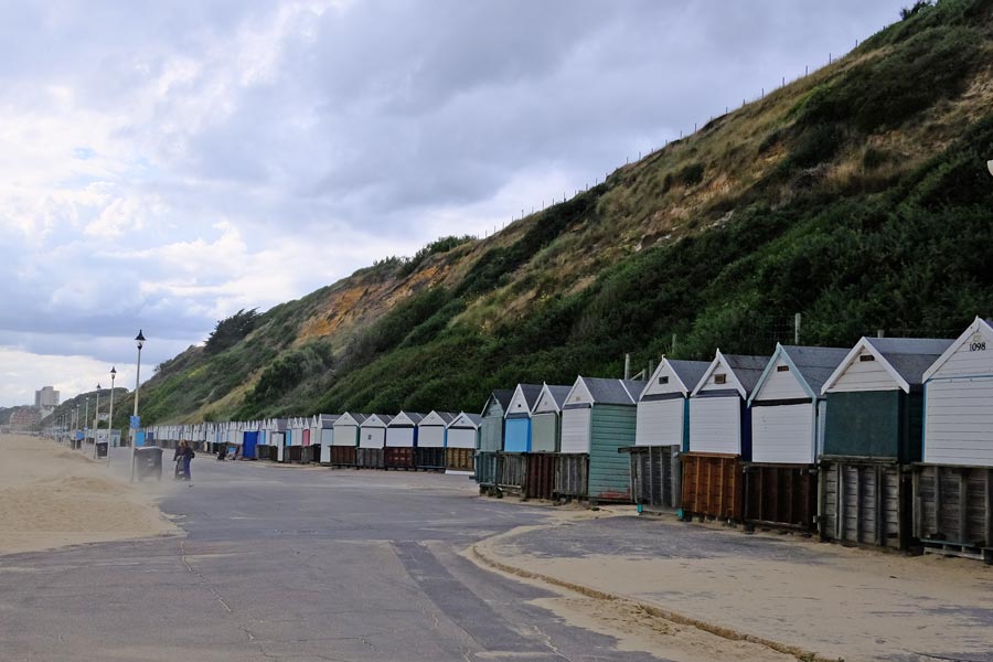
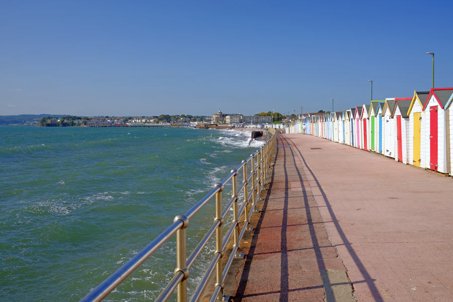
Beach Huts
Coming into Bournemouth I couldn't help but notice that there were a lot of beach huts. I notice that some had numbers over a thousand.
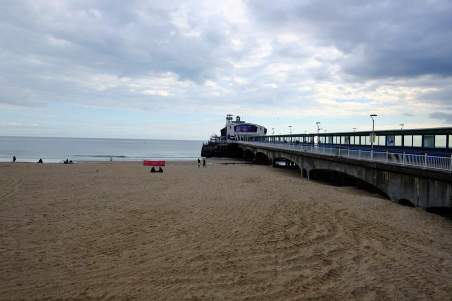
Bournemouth Pier.
By the time I got to Bournemouth Pier the weather was getting threatening.

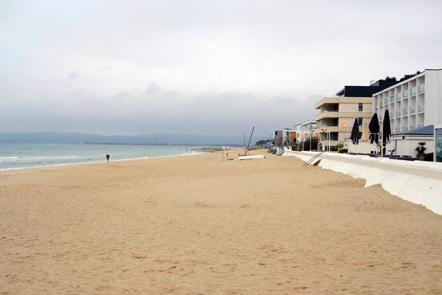
Heading toward Sandbanks.
After resting at Bournemouth I continued on. Beach huts were once again lining the promenade and disappearing into the distance. I wondered how many? The weather was worsening now. It was still dry but rain was visible in the distance.
Sandbanks.
At Sandbanks the promenade ended because the posh houses and flats are built right up to the beach. The rest of the walk was along the pavements of the road to the ferry. There were a few spots of fine rain falling but they were quickly drying on my clothes. Bad weather was now forecast but I was almost where I wanted to get to.
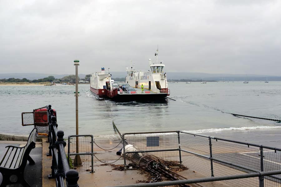
The Sandbanks Chain Ferry to South Haven Point.
I waited at the ferry point for a number 50 bus which crosses to South Haven Point on the ferry and then on to Swanage. As it drove onto the ferry, the rain started. It took three buses to get home. It rained solidly all the way.
About 18 miles walked. Easy walking all the way. Most of it dry.
(I later found out that there are well over 2000 beach huts along Poole Bay!)
back to Hampshire Border start
back to the top of the page
The SWCP in reverse. South Haven Point to Lyme Regis, 2022.
South Haven Point to Langton Maltravers
Langton Maltravers to Kimmeridge
Kimmeridge to Lulworth
Lulworth to Weymouth
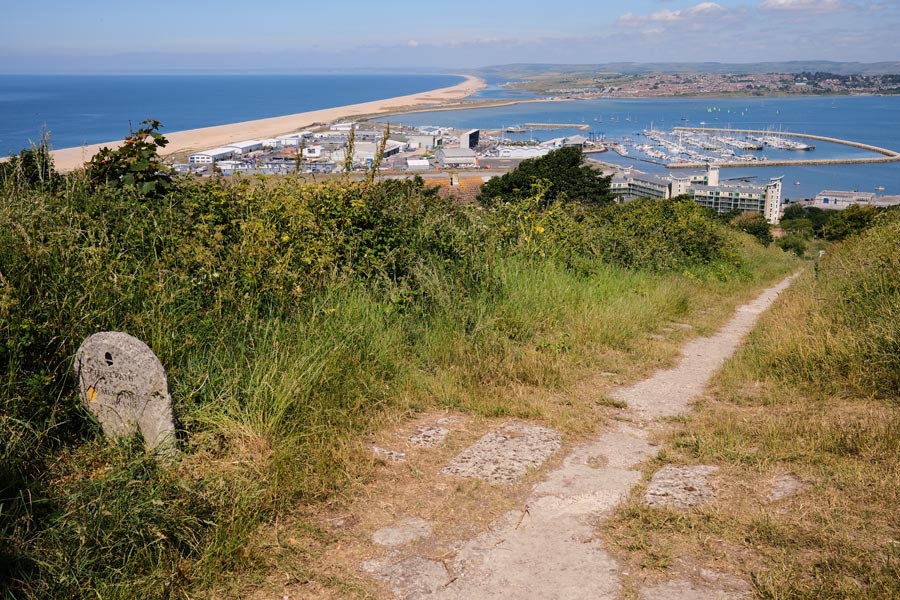
Round the Isle of Portland
Weymouth to Abotsbury
Abotsbury to West Bay
West Bay to Lyme Regis
Walking in the opposite direction to my SWCP walk in 2004.
Day 1: South Haven Point to Langton Maltravers

The end of the journey for most SWCP walkers is here at South Haven Point, as the most popular direction to walk the whole path is from Minehead to here. Having walked the SWCP in the normal direction several years ago I decided to walk it in the reverse direction. It began with an easy walk on the damp sand just above the waterline to Redend Point at Studland.
 |
 |
| Old Harry Rocks. |
Swanage from Ballard Down. |
|
|
| Old Harry Rocks. |
Swanage Bay from Ballard Down. |
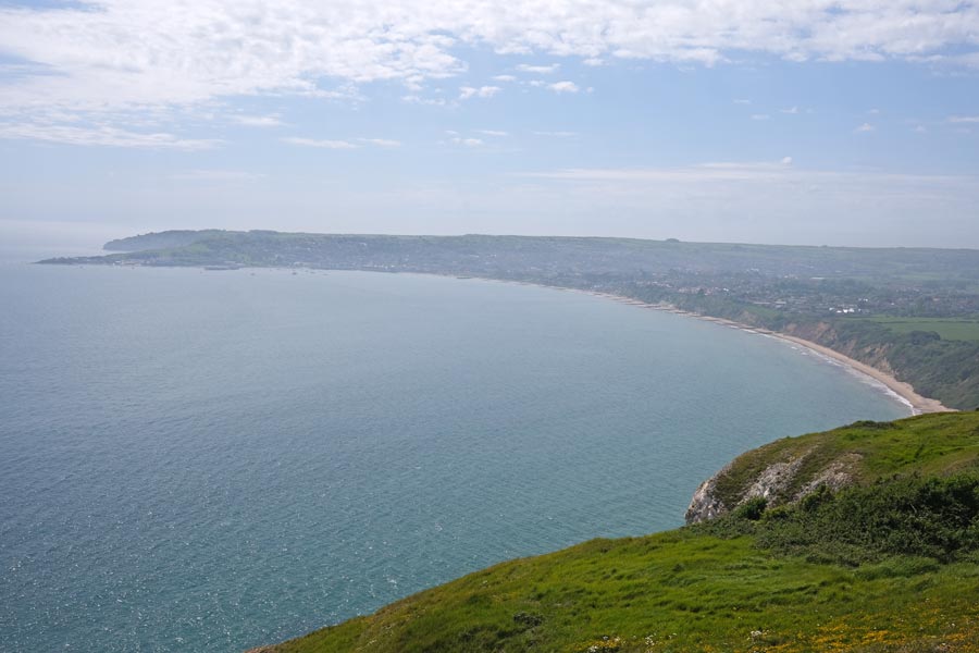
At Studland I rested in the beer garden of the Banks Arms which overlooks the sea. Much refreshed, I continued out on the headland to Old Harry Rocks. These chalk stacks mark the eastern end of the 95 mile-long Jurassic Coast stretching to Exmouth in Devon. At Ballard Down I missed the path down to Swanage and walked half a mile too far inland before backtracking. In Swanage I had a pint in the White Horse Inn because the other pubs were too hot and busy. Much refreshed I continued along the coast to Dancing Ledge, where the sea washes over the rock ledge and bobs about as if dancing. Here I diverted inland to Langton Maltravers to catch a bus back to my accommodation.
End of day 1. About 11 Miles walked today.
It was hot day with a few clouds now and then, including a short downpour just as I headed inland for the bus stop at Langton Maltravers. This turned out to be the only time that I got wet on my walk along the Dorset coast.
back to the start of Dorset in reverse
back to the top of the page
Day 2: Langton Maltravers to Kimmeridge.
 |
 |
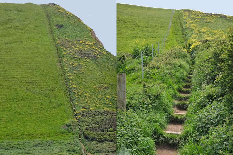
| Steps! |
Almost at Kimmeridge |
After a short walk from Langton Maltravers back to the coast I came to St Aldhelm's Head where the terrain began to get more challenging. I know that steps are necessary on very steep slopes but my knees really don't like them any more! Approaching Kimmeridge the Isle of Portland is visible on the distant horizon. Kimmeridge is a small village a short walk inland from the beach. It had minimal services, apart from a very nice restaurant. It had no bus service and no mobile phone coverage either. There was a phone box, which didn't take cash, and wouldn't accept my credit card, but a very nice lady in the very nice restaurant kindly called the local KBay Taxi for me, which took me back to my accommodation.
End of day 2. About 10 miles walked today. Hot.
back to the start of Dorset in reverse
back to the top of the page
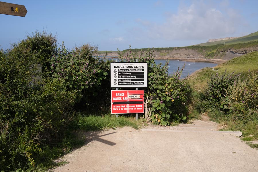
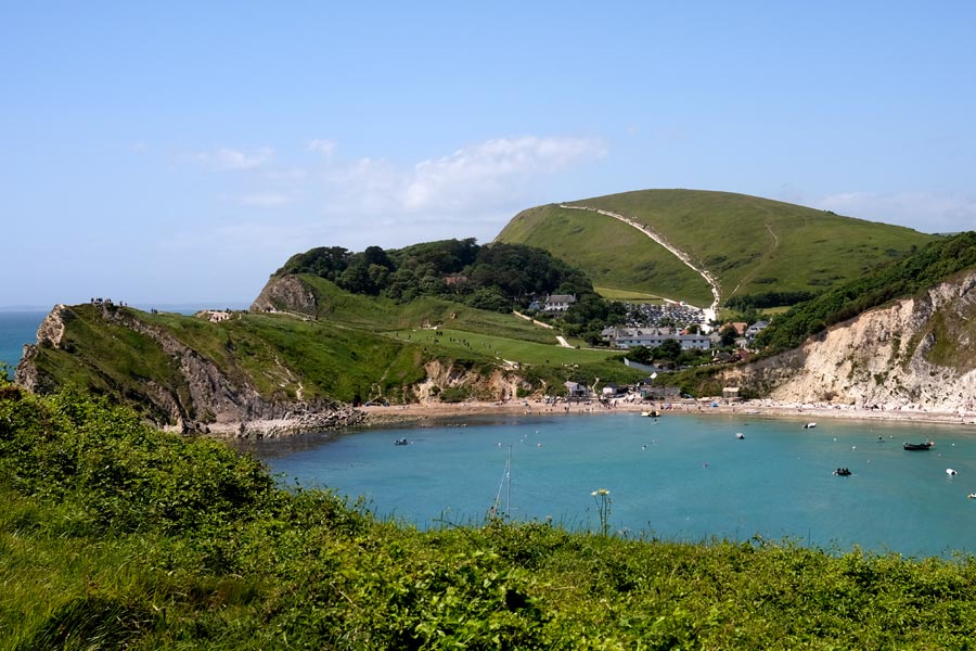
Day 3: Kimmeridge to Lulworth
 |
 |
| Lulworth Range Warning Notice |
Brandy Bay |
 |
 |
| Challenging |
Lulworth Cove |
The road from Kimmeridge village to the beach is a toll road for vehicles but I was on foot. From the beach, the path going west first passes through the Army firing range, with warning notices at the entry point. Further on there was a "Do not pick anything up" notice. From here to Lulworth village the path is only open certain weekends and weekdays per year. For more information Google 'Lulworth Range access times' and choose the .gov.uk site. The village of West Lulworth was very busy and it was still a very hot day, so as I was passing the Lulworth Cove Inn I stopped for a pint in the beer garden. As I live in West Dorset I was able to catch a bus to Weymouth and then to Bridport and go home for the night.
End of day 3. Only 8 miles walked today, but it was a severe section, and it was very hot!
back to the start of Dorset in reverse
back to the top of the page
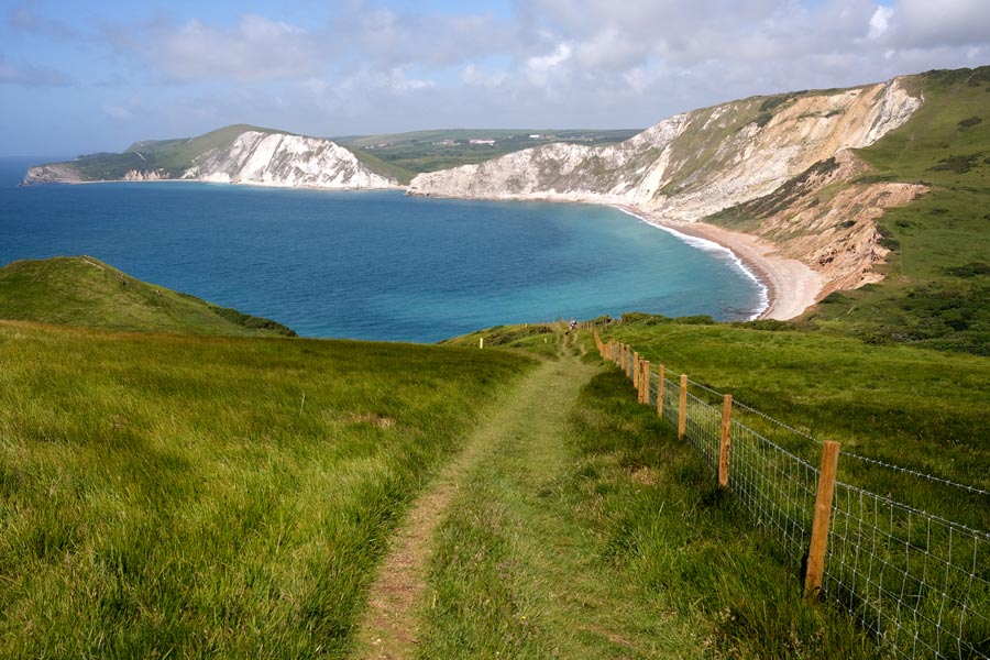
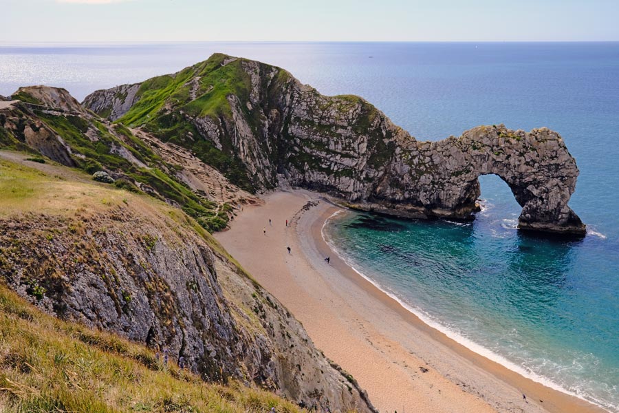
Day 4: Lulworth to Weymouth
After two bus rides to get back to Lulworth I walked to Durdle Dor. There was almost no one around. It was going to be another hot day. I seem to have chosen to walk the coast of Dorset during a heat-wave.
 |
 |
| Durdle Dor |
Well trodden paths |
 |
 |
| Looking back to Durdle Dor |
Always close the gate behind you |
I make a habit of regularly stopping and turning round just in case I have missed a good view and the chance of taking a photograph.
 |
 |
| Ringstead Bay |
Osmington Mills |
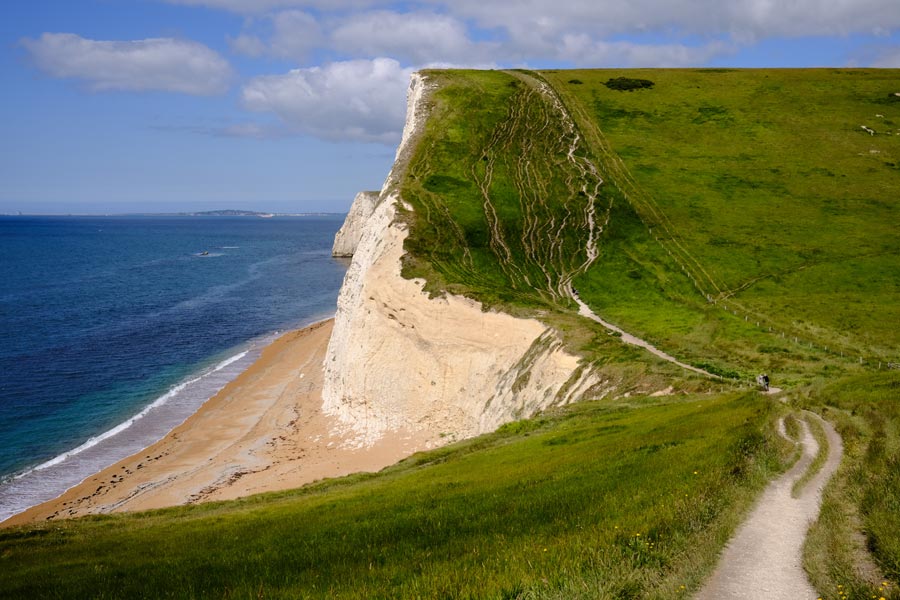
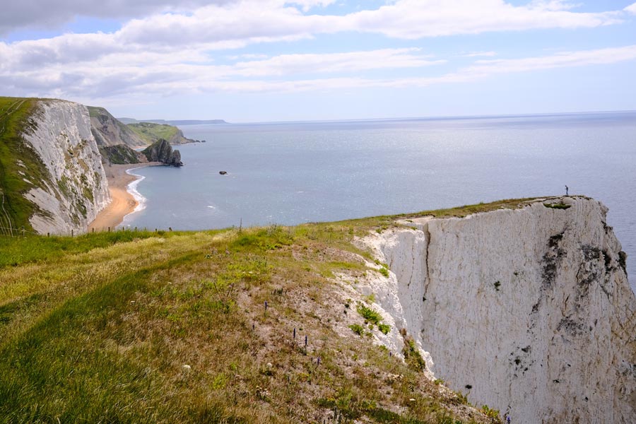
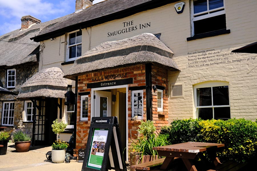
Just before Osmington Mills the cliffs droped away and the going gets easier. At Osmington Mills the path goes right through the garden of the The Smugglers Inn. There was a shady table waiting for me in the beer garden.

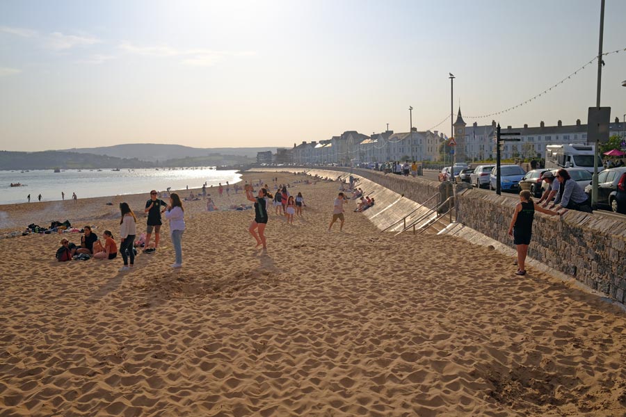
After a cool refreshing pint it was an easy 5 mile walk to Weymouth town centre, about half of it being along the promenade.
End of day 4. About 13 miles walked today. It was a hot day with a few clouds now and then.
back to the start of Dorset in reverse
back to the top of the page
Day 5: From Weymouth round the Isle of Portland (Clockwise)
 |
 |
| Portland |
At the top |
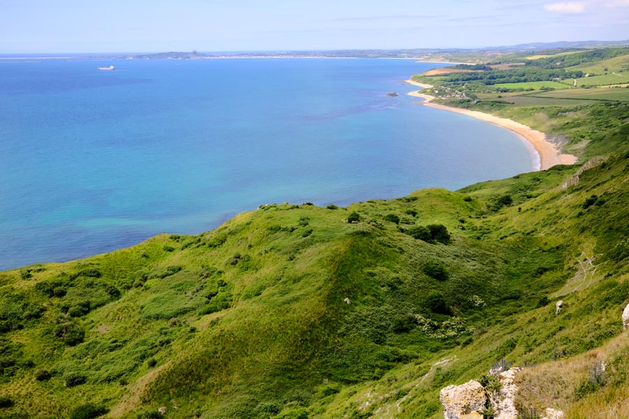
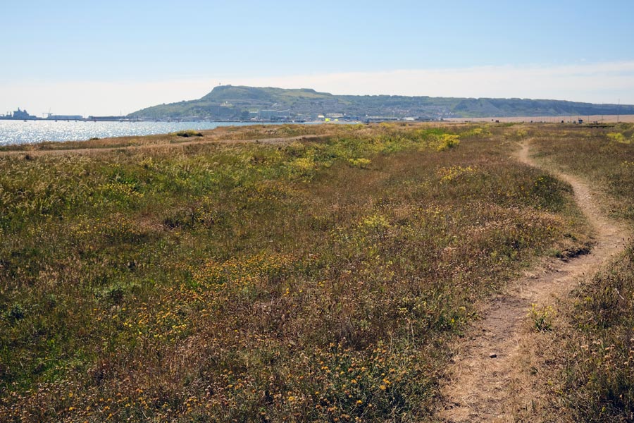
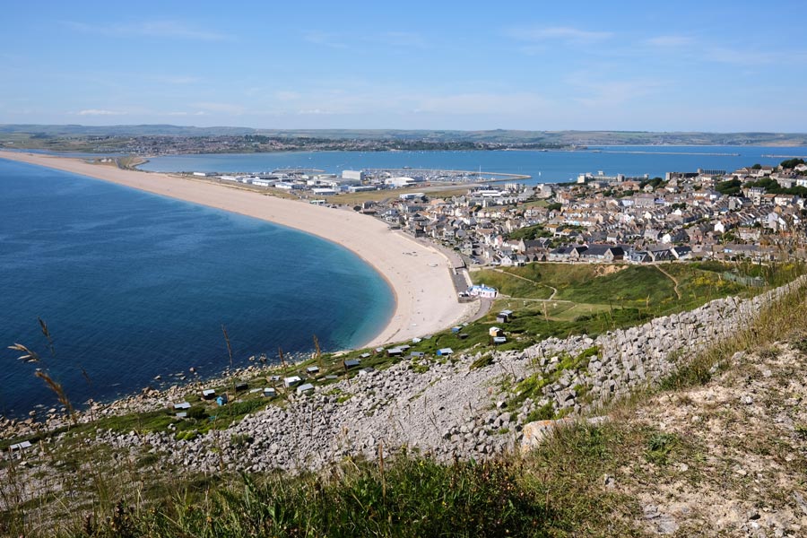
From Weymouth town centre it is a 2.5 mile walk to the start of the causeway to Portland. There is a pavement alongside the causeway road but it is more pleasant to walk along the tracks through the scrub away from the noisy traffic. The path meanderes through the marina of Portland Harbour then through a scruffy area, through a dingy tunnel and up a long slope called the Merchant's Incline, an abandoned tramway that used to take the limestone rock from the quarries down to the docks below. From the top there is a view of Chesil Beach curving away into the distance, with the causeway in front of it and the start of Weymouth town to the right.
 |
 |
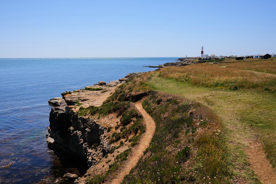
| Portland Bill |
West Cliff |
After passing the HM Prison and the Young Offender Institution the path drops down to the under-cliff on the east side of Portland via a steep and torturous path. There was no wind down there so I was getting very hot in the blazing sun. The path then climbs back up to pass along the road for a short distance then drops down again passing remnants of old quarry workings and a little town of holiday "sheds" before reaching the lighthouse at Portland Bill. Here there is a restaurant and a snack bar and in the large car park there are toilets. I cooled down with a pint under an umbrella at the Pulpit Inn..
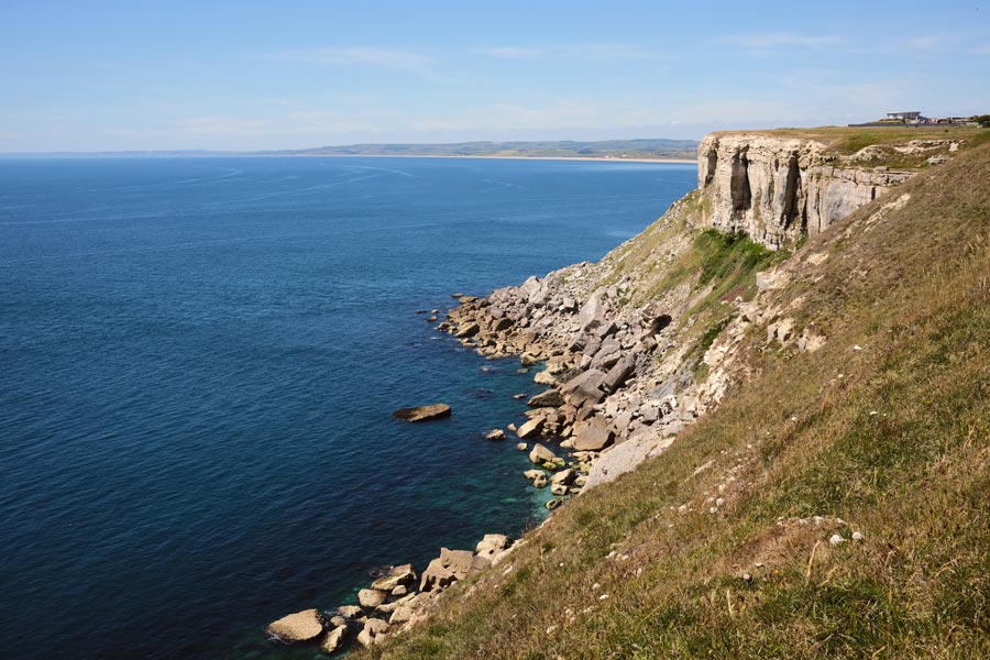
After Portland Bill the path continues along the cliff top on the west side of the island. There was a cool breeze blowing. There were a couple of diversions where the path had partly collapsed, one of which sent the path through Tout Quarry. It is worth a detour through the quarry anyway to look at the many contemporary rock carvings there, although some are hard to find.
Chiswell
At the end of the cliff there is a steep descent to the beach at Chiswell and the Cove House Inn, but when I got there it was packed and there was no shade outside so I walked on to the Little Ship Inn where I sat outside in the shade with a pint before walking back along the causeway to the mainland.
End of day 5. About 16 miles walked today. A hot day but there was a cool breeze on the west facing cliffs and when walking back along the causeway.
back to the start of Dorset in reverse
back to the top of the page
Day 6: Weymouth to Abbotsbury
 |
 |
| The Fleet looking east |
The Fleet looking west |
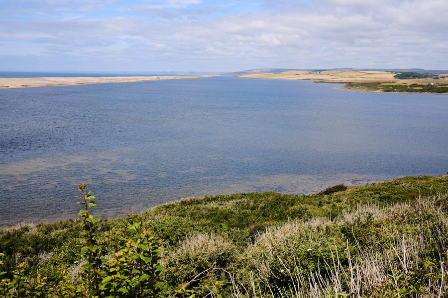
Continuing my walk from the Weymouth end of the Portland causeway, the path passes alongside the landward side of the Fleet. The fleet is a long lagoon almost completely cut off from the sea by Chesil Beach, which at this point is a huge bank of pebbles. The first photo was taken looking back along the Fleet, with the back of Chesil Beach on the right, the causeway across the end and Portland beyond. This second photo is looking forward along the Fleet, with the back of Chesil beach on the left and Lyme Bay behind it on the left horizon. It was very hot, so after a few miles I stopped at the Moonfleet Manor Hotel for a pint. But they didn't serve pints. I sat under an umbrella on the patio and was served with a bottle of cold beer instead.
After about 7 miles along the shore of the Fleet the path diverts inland towards Abbotsbury and passes St Catherine's Chapel high on the hill. Services are occasional held here throughout the year. I walked into the Village of Abbotsbury and caught the coastal bus home.
End of day 6. About 12 miles walked today. A hot day with very little cloud.
back to the start of Dorset in reverse
back to the top of the page
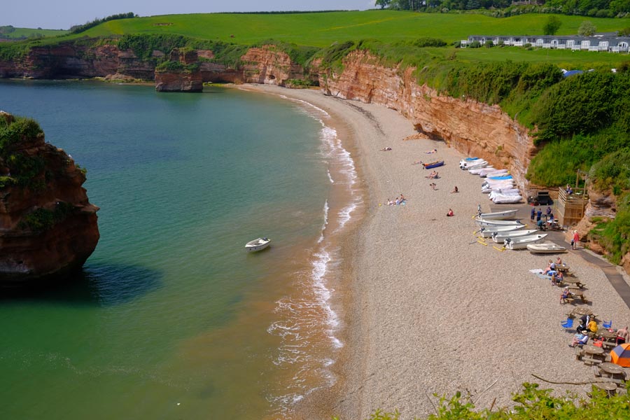
Day 7: Abbotsbury to West Bay
 |
 |
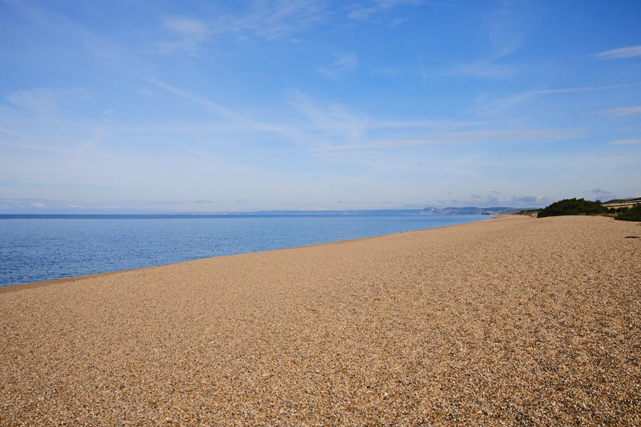
| Chesil Beach |
Burton Bradstock |
Starting from Abbotsbury the path heads back to the coast and Chesil Beach. The pebbles are now smaller than those at the Portland end. Walking on the pebbles is hard going but after a time the path diverts into the adjoining fields and along the back of the beach. This is sign-posted as the 'Summer route'. At other times the fields can be too marshy and then it is necessary to keep to the beach.
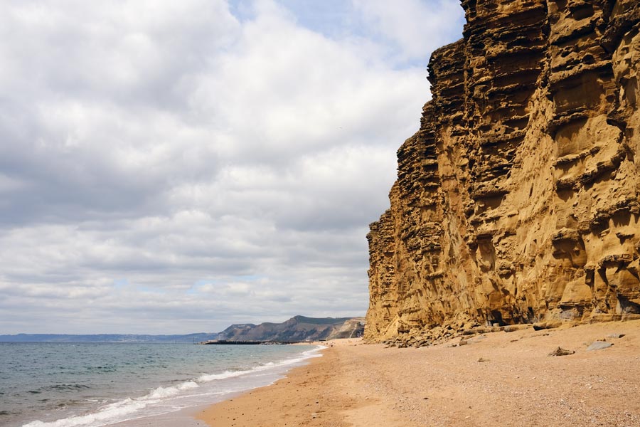
At Burton Bradstock I descended cliffs to Hive Beach. The cafe/restaurant here is open all-year-round. From here to West Bay there is a spectacular line of cliffs that glow in the early morning and evening sun. There are regular cliff falls along this stretch of the coast making the cliffs too dangerous to walk under or to walk along the top near the edge. At a very low tide it is possible to walk along the beach away from the cliffs but sometimes a cliff fall blocks the beach right up to the water's edge and into the sea. It is dangerous to attempt to climb over any part of the fall. It produces a very sticky mud, often with a hard crust, and it is impossible to escape from this mud if you get bogged down.
 |
 |
| Burton Freshwater |
East Cliffs West Bay |
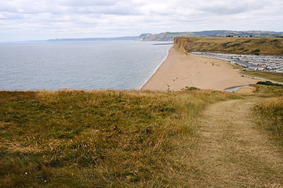
After leaving the beach at Burton Bradstock, by walking through the large car park and across a cliff-top field, there is the start of a road that goes inland to the village of Burton Bradstock, where there are two pubs. But I continued on along the cliff top path to Burton Freshwater where there is a large static and touring caravan park. Here the path diverts inland a short way to a small bridge that crosses the River Bride. before returning to the beach.
The tide was going out but walking along the beach at West Bay it dangerous if it means getting too close to the unstable cliff face. The path continues along the cliff-top but keeps well away from the edge. West Bay, also known as Bridport Harbour, is a small coastal community with a large static-caravan park. It also has harbour-side kiosks selling food, including fish & chips and ice-cream. I followed the footpath through the caravan park to Bridport which is almost 2 miles inland, where I had a pint in the The Pursuit of Hoppiness before catching a bus home.
End of day 7. About 9 miles walked today. A hot day to start with but later the clouds helped to cool it a little.
back to the start of Dorset in reverse
back to the top of the page
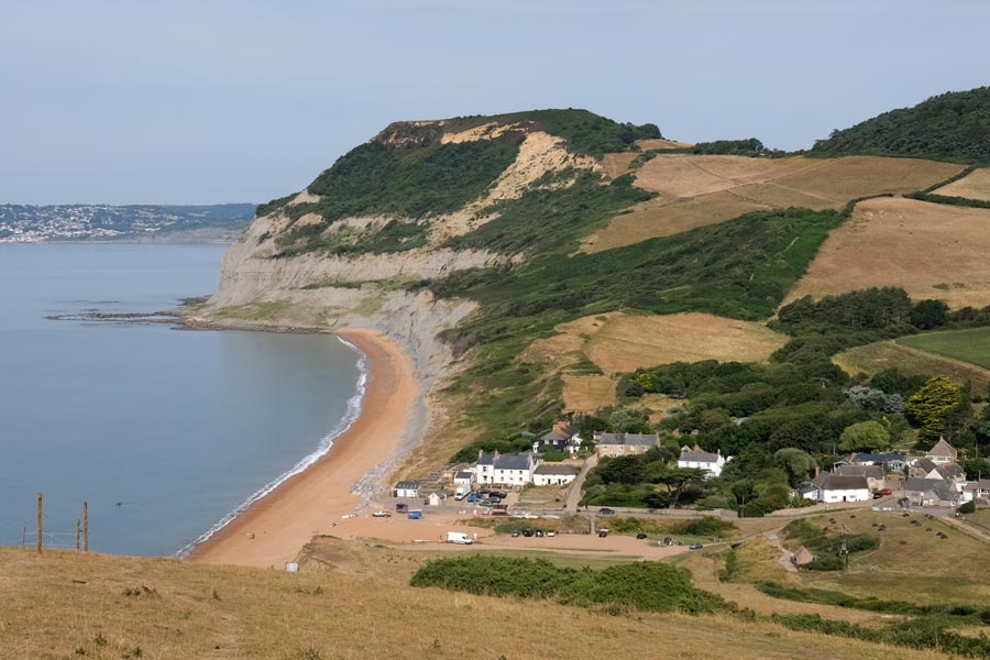
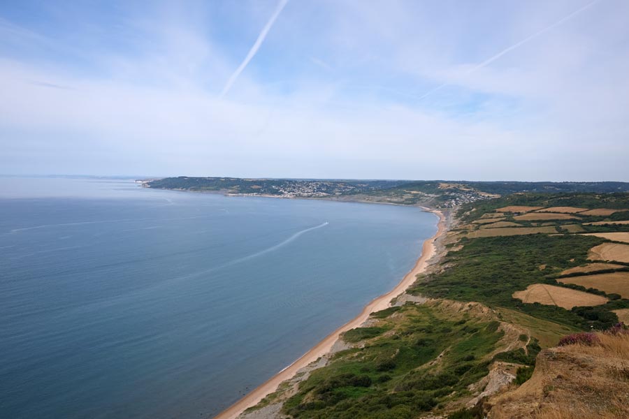
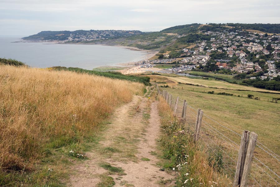
Day 8: West Bay to Lyme Regis
 |
 |
| Land slip |
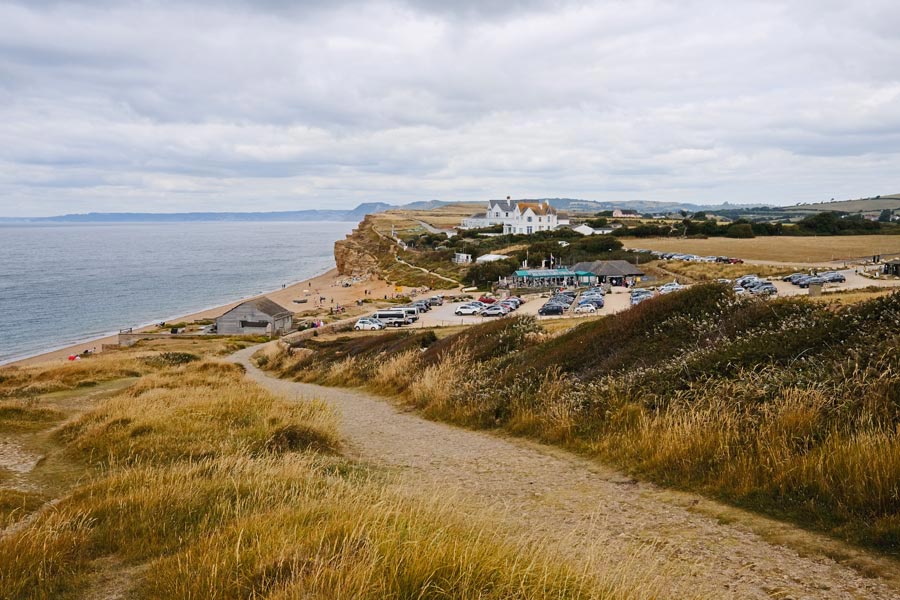
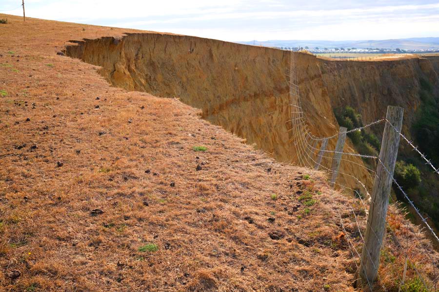
The climb to Thorncombe Beacon |
There have been large land slips on the section between West Bay and Lyme Regis. This land slip was between Eype and Thorncombe Beacon. From West Bay the path continues up onto the cliffs then down again to Eype Mouth beach, then up again to Thorncombe Beacon. The beacon, a fire basket on a pole, is just visible in the photo. Notice the brown grass due to the long dry-spell.
 |
 |
| Seatown and Golden Cap |
The view from Golden Cap |
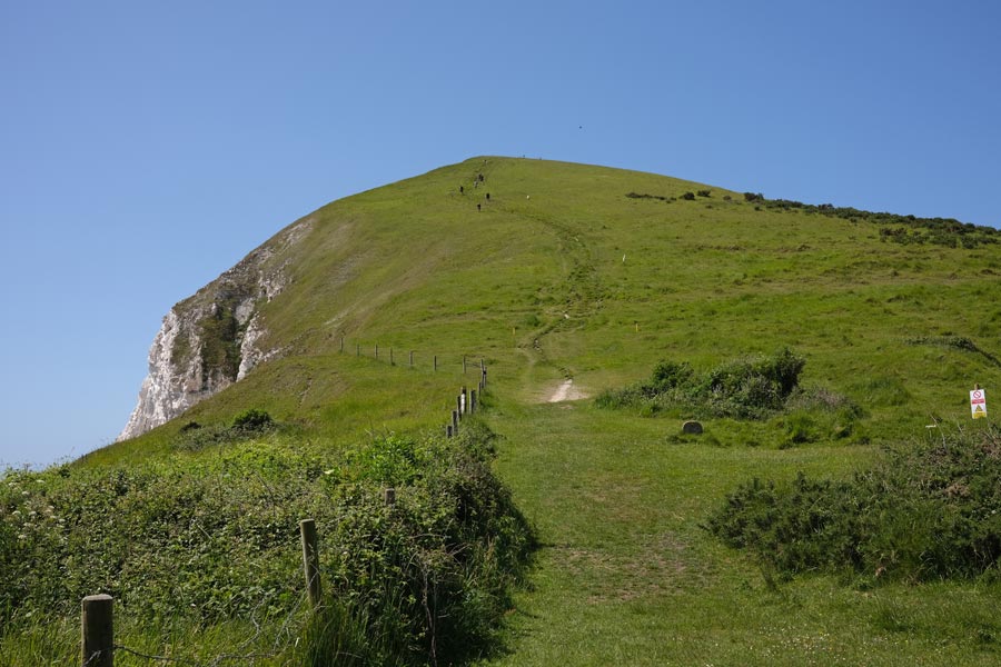
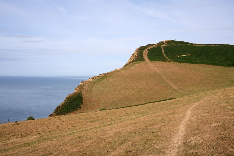
From Thornecombe Beacon there is a steep descent to Seatown and the Anchor Inn next to the beach. Golden Cap is beyond. From Seatown it is a short walk inland on the road to reach the path to climb Golden cap. The old path along the headland is no longer useable due to land slips. Golden Cap is the highest point on the south coast.
View from Golden Cap
A view of Charmouth ahead and Lyme Regis beyond.
 |
 |
| Charmouth |
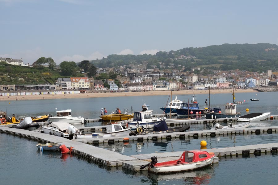
View of Lyme Regis from the Cobb |
The inland diversion via Stonebarrow Hill between Golden Cap and Charmouth is no longer necessary as a section closer to the coast is now in use. At Charmouth there is still an inland diversion to Lyme Regis, partly along roads. From Charmouth, Lyme Regis is approached from the landward side with no chance of a nice view of the town to photograph. I had time to spare before catching a bus to Bridport so I had a pint in the Naval Volunteer first.
End of day 8. About 10 miles walked today.
That's a total of 89 miles on the Dorset South West Coast Path.
back to the start of Dorset in reverse
back to the top of the page
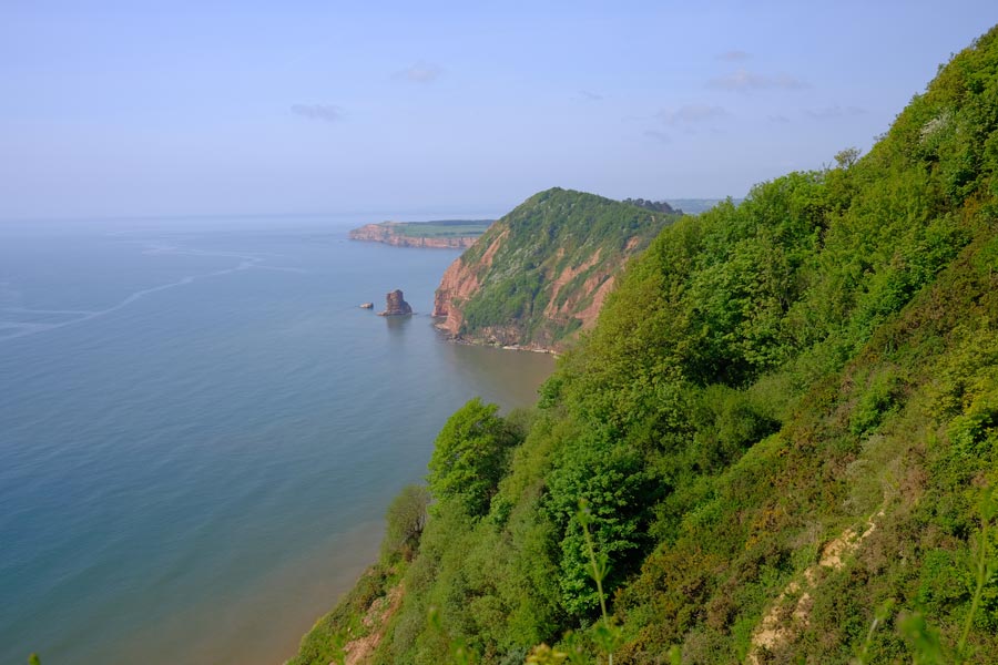
The SWCP in reverse - East and South Devon 2023.
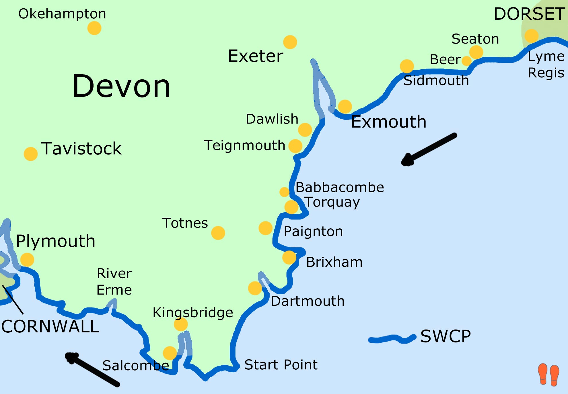
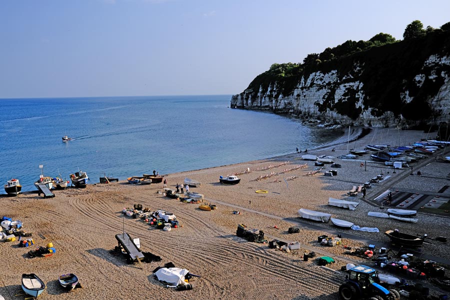
Day 1: Lyme Regis to Beer
Day 2: Beer to Sidmouth
Day 3: Sidmouth to Exmouth
Day 4: Exmouth to Teignmouth
Day 5: Teignmouth to Babbacombe
Day 6: Babbacombe to Brixham
Day 7: Brixham to Dartmouth
Day 8: Dartmouth to Salcombe
Day 9: Salcombe to River Erme
Day 10: River Erme to Plymouth
Day 1: Lyme Regis to Beer
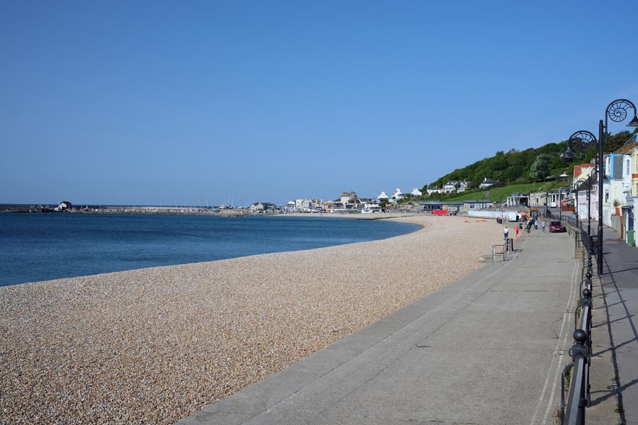 |
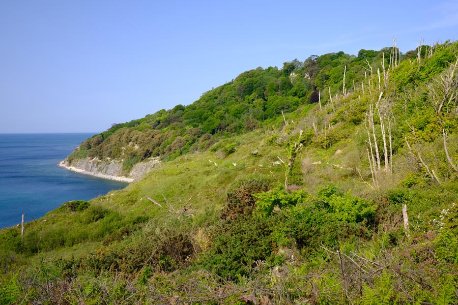 |
| Lyme Regis early morning |
The undercliff |
Lyme Regis is in Dorset but after half a mile the path enters Devon. The path leaves the car park next to the Cob and rises up to the undercliff. This is a long strip of land that has slumped and lies between the real cliffs above and the sea cliffs below. There is no access up or down from the path. After about half-mile into Devon the path enters the undercliff woodland and continues through the trees for several miles. The sound of the sea is mixed with the sounds of the woodland and there are glimpses of the sea now and then. I seem to have chosen another hot day to start my trek but in the woodland it was much cooler.
 |
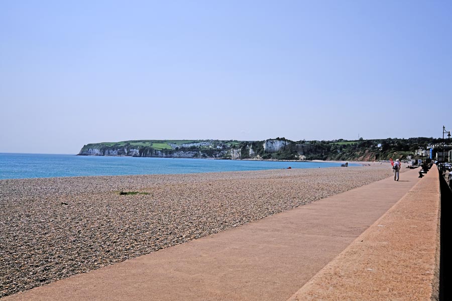 |
| The Golf Club |
Seaton |
The path twists and turns up and down until the undercliff is no more and rises up onto the cliff before crossing the golf course and dropping down (past the club house, visitors welcome) to sea level at Seaton. I made a visit but only for water. At Seaton I had a pint in the Eyre Court Hotel. Nice cool bar and shady beer garden. Then, because the tide was out, I was able continue out of town and along the pebble beach and avoid the inland diversion caused by a collapsed road and footpath, then I ascended the cliffs, visible in the centre of the above photo, before descending into Beer.
 |
| Beer early evening |
I arrived in beer mid afternoon. The going was not very strenuous but I was worn out. Unlike my trek through Dorset I was now carrying a tent, inflatable mattress, sleeping bag and other camping gear as I intending to stay at campsites whenever possible to save on the cost of accommodation. My rucksack now weighed about 12 kilos. I decided to stop for the night at the camp site on Beer Head. I walked beyond the town to the campsite, pitched the tent, had a refreshing shower and returned to the town for a pint and a snack at the Anchor Inn. I hoped that I would soon get used to carrying the extra weight.
End of day 1. About 9 miles walked today.
back to the start of Devon in reverse
back to the top of the page
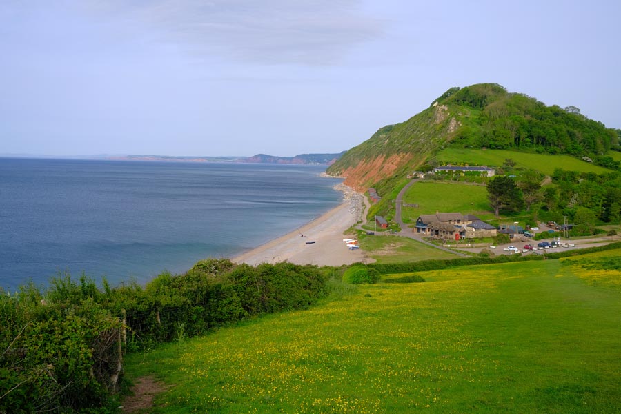
Day 2 - SWCP Beer to Sidmouth.
 |
 |
| Branscombe Mouth |
Salcombe Regis |
I decided to walk to Branscombe before having breakfast. I had bought a large pasty before I left Beer and I stopped at Branscombe Mouth and ate it at one of the picnic tables on the beach. Then I ascended through the woodland and onto the cliff top, where the going was easy for a time, but it didn't last. Then came two very steep descents and ascents at Weston Mouth and Salcombe Regis. There was light cloud and a breeze but I found it hard going.
 |
| Sidmouth |
Then came one last steep descent into Sidmouth. I was worn out by then so I found accommodation for the night. My knees and hips were complaining and my shoulders were sore from the pack straps but mainly I had run out of energy again. A shower, fish and chips and a pint cheered me up. I even managed a stroll around the town afterwards.
End of day 2. About 9 miles walked today.
back to the start of Devon in reverse
back to the top of the page
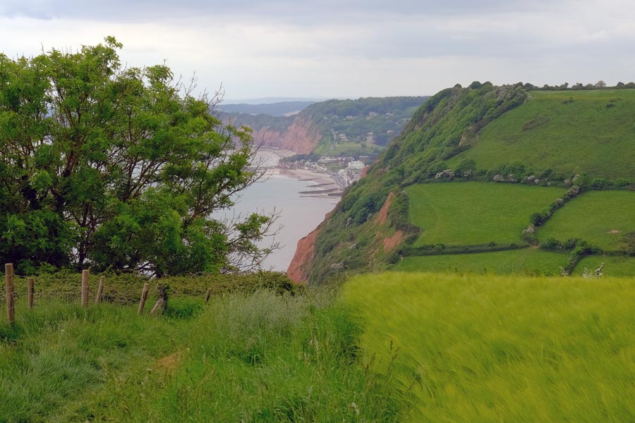
Day 3 - SWCP Sidmouth to Exmouth
 |
 |
| High Peak |
Ladram Bay |
After a 'full English' at Sidmouth there was some strenuous walking followed by some moderate walking according to the official Reverse Guide. I could see that the land was flatter in the distance. It was becoming another hot day with little cloud and but there was a cool breeze. The path was very narrow in places with high hedges on both sides. Being sheltered from the cool wind by the hedges it was very hot and moist and the views were restricted. At the Ladram Bay holiday caravan and campsite I refilled my water bottle.
 |
 |
| Budleigh Salterton |
Exmouth beach - town end. |
The path to Budleigh Salterton was much easier. I walked into the town and had a snack and a pint at The Feathers. The going to Exmouth was pleasant but it was very hot. When I got there, beach was busy with people swimming, paddle boarding, playing volley ball and barbecuing. I was glad to have arrived. But I hadn't. I had forgotten just how long the beach was. So I trudged on in the heat for another mile and a half to reach the town end and found some accommodation. I had an early night.
End of day 3. About 13 miles walked today.
back to the start of Devon in reverse
back to the top of the page
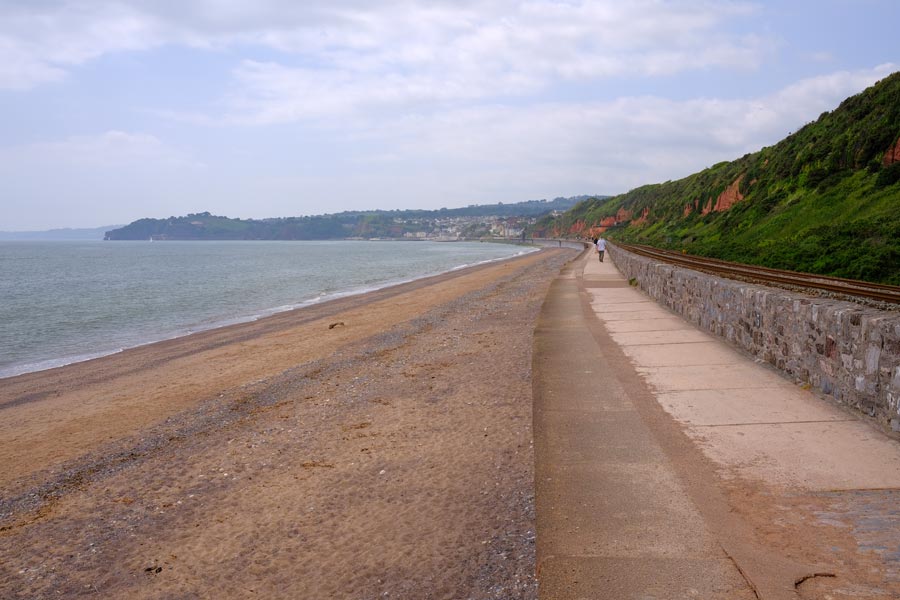
Day 4 - SWCP Exmouth to Teignmouth
 |
 |
| Looking back to Exmouth |
Dawlish to Teignmouth walkway |
The first ferry across the River Exe from Exmouth to Starcross was at 10:40 so I had time to wander around the town. I found a popular cafe in the docks and had a bacon sandwich and a drink, then I just sat on a bench nearby for an hour watching the people and the boats and waited for the ferry. It was an easy walk along footpaths from Starcross to Dawlish Warren, where I had a lunchtime snack and a pint in the Silly Goose before joining the walkway that runs between the beach and the railway line towards Dawlish.
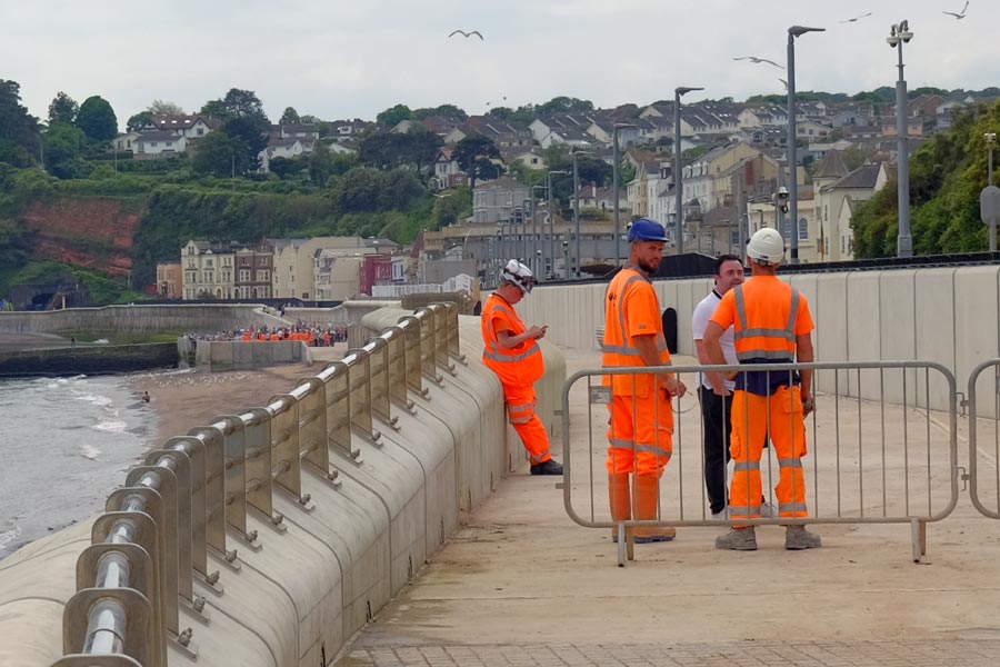 |
| Waiting for 2 o'clock |
I had been told by the barman at the Silly Goose that at 2 0'clock the were going to officially open the final part of the new walkway that ran along the new sea defences and the railway line at Dawlish. So I took my time but still arrive half an hour before the opening. I could have taken a detour through the town but I decided to wait. There were a few people standing near the barrier and more walkers arrived while I was waiting. Most of them seemed to have been unaware of what was happening until they were told by the men at the barrier.
In the distance I could see the official opening taking place (see photo) and just before 2 o'clock the barriers were removed and we were allowed to move forward. By the time that we got to the other end, the opening had been performed and a large crowd was surging forward towards us. I continued to walk on. After leaving the railway walkway at Dawlish the route became a little more strenuous before rejoining the railway walkway again for the last 1.5 miles into Teignmouth. It was very hot but a cool wind was blowing.
End of day 4. Only about 8 miles walked today.
As I walked I decided that I was carrying more weight in my rucksack than I could comfortably carry. Either I wasn't as fit as I thought, or my age was catching up with me. So I took the next train home to Dorset and lightened my pack. Because the weather was supposed to stay fine I discarded the tent along with my heavy bad-weather clothes and my spare clothes. I managed to reduced my pack from 12Kg to about 8Kg, which included a light sleeping bag and a bivvy bag. I rested for a few days and booked a few B and Bs for the first part of the onward journey.
back to the start of Devon in reverse
back to the top of the page
Day 5 - SWCP Teignmouth to Babbacombe
 |
 |
| The Teignmouth to Shaldon Ferry |
The end of Oddicombe Beach |
Returning to Teignmouth by train I took the ferry across the River Teign to Shaldon. It now late morning and it was hot. The walk to Babbacombe was strenuous but there was plenty of shade from the trees and hedges along the route. I stopped at the Thatched Tavern at Maidencombe for a pint and a top-up of my water bottle. At Babbacombe there was a long descent to Oddicombe Beach followed immediately by a steep ascent to where my B and B was. After a shower I had time to walk part of tomorrows route into Torbay before returning to Babbacombe for a pint and a meal at the Babbacombe Inn, which was on the cliff top near my B and B.
End of day 5. About 8 miles walked to get to Babbacombe plus a couple more towards Torquay marina.
back to the start of Devon in reverse
back to the top of the page
Day 6 - SWCP Babbacombe to Brixham
 |
 |
| Early morning. Torbay. |
Paignton |
 |
 |
| Paignton to Kingswear Heritage Line |
Arriving at Brixham |
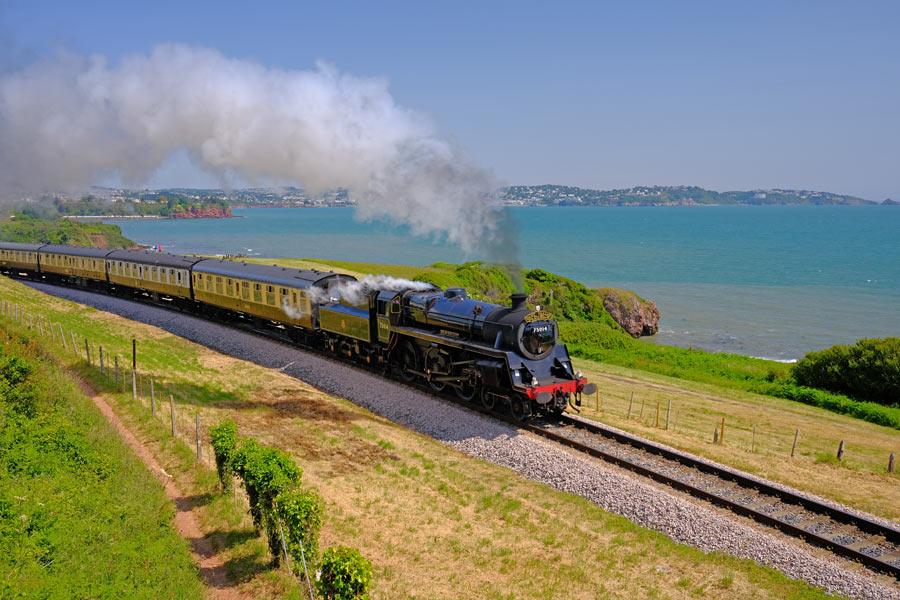
Next day I made an early start and was able to take a short cut through the town as I had already walked part of the route beforehand. I rejoined the path at the marina on the Torquay seafront. At Paignton I walked into the town to buy some large safety pins. I always take two pairs of walking socks and I had washed one pair the night before at the B and B. But they were still wet so I hung them on my rucksack to dry and nearly lost one as I walked. Unfortunately I had to wait until 10am for the safety pin shop to open. I bought two large kilt pins and hung the damp socks on my rucksack.
As I walked into Goodrington Sands with my socks swinging in the breeze a Kingswear to Paignton Heritage Railway steam train passed by on its way to Paignton. Later, when I was walking right alongside the line it passed by again on its way back to Kingsbridge. I was glad that I had been delayed at Paignton as I was at a perfect spot to take a photo. Due to my early start and it being a moderately easy walk I arrive in Brixham mid afternoon. It was a very hot day but there was a cool wind blowing so after a brief rest I continued on along the coast to Berry Head and then came back to my Brixham B&B via St Mary's Bay. That evening I walked back into town and had a meal and a pint or two at the Old Market House on the quay.
End of day 6. About 14 miles walked today.
back to the start of Devon in reverse
back to the top of the page
Day 7 - SWCP Brixham to Dartmouth
 |
 |
| Scabbacombe Head |
Forward Point |
As I had walked part of this section through Brixham the day before so I rejoined the path at St Mary's Bay. It was hard going at Man Sands and Scabbacombe and it was another hot day but there was a cold wind blowing on the exposed cliff tops and even more wind was blowing up the valleys between them. Just before the path rounded the point and continued along the river Dart I visited the ruins of the World War II defences at Forward Point. Start point is visible in the distance on the extreme left of the photo. It had been a hot day so far but the cold winds had helped to cool me a little.
 |
| The Kingsbridge - Dartmouth Ferries |
After Forward point the path passed through the cooler and shady Warren Woods, then it descended on a narrow road, giving glimpses of Dartmouth between the many expensive housed that were crammed along the steep bank of the river. I crossed to Dartmouth on the ferry and went straight to The Crab, which has an outdoor seating area on the quay, and sat under an umbrella with a pint of lager and a snack until I had cooled down. I had booked into the Seven Stars where, after a shower and a wander around the town, I later returned for a pint and a nice meal.
End of day 7. About 10 miles walked today.
back to the start of Devon in reverse
back to the top of the page
Day 8 - SWCP Dartmouth to Salcombe
 |
 |
| Blackpool Sands |
Slapton Sands with Torcross at the far end |
I left early and hoped hope that it would be cooler than the last few days, and it was. It was cloudy with a cold easterly wind. The first stretch was strenuous so I soon warmed up enough to walk in a polo shirt, but as the going got easier I began to speed up to keep warm. I could have put my fleece back on instead but I wanted to see if I could improve on my mileage. My daily mileage had been quite low so far, partly because I was stopping frequently to take more interest in my surroundings than I did on my previous SWCP walk twenty years ago but mostly because I was walking more slowly than I did then. I stopped at the Blackpool Sands beach cafe for coffee and breakfast.
By midday I had passed Slapton Ley Nature Reserve and arrive at Torcross village. After topping up with water I kept going. The cloud had lifted and it was getting hot again so I stopped at The Cricket Inn in Beesands for a pint and a snack.
 |
| Narrow and rocky |
The going was getting strenuous and parts of the path were narrow and very rocky. Just before Prawle point a chap who engaged me in conversation told me that Salcome was not far, that there was spectacular scenery, and that the difficult bit was behind me. I shouldn't have listened to him. I was already tired and thinking of camping for the night but then I decided to keep going. After Prawle Point lookout station the scenery was certainly spectacular but the path continued to be difficult and slow until the final descent to East Portlemouth. But by then it was late and I was sure that the ferry across to Dartmouth would have stopped running. I arrived in the dark just before 10 o'clock and was pleased to see the little ferry heading across the river towards me. The ferryman had been booked to take two passengers back to Dartmouth at 10 o'clock so I was able to join them. I could not find accommodation in Salcombe so I spent the night in my bivvy bag in a discrete but not very comfortable location.
End of day 8. 23 miles walked today. My best so far.
back to the start of Devon in reverse
back to the top of the page
Day 9 - SWCP Salcombe to the River Erme.
 |
 |
| Sunrise as I left Salcombe |
Between Bolt Head and Bolt Tail |
 |
 |
| Hope Cove. |
Heading for Bantham. Burgh Island ahead |
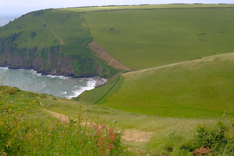
I made a 4am start and decided to get to the River Erme, where there is no ferry but where it was safe to wade across the river one hour either side of low tide. This would avoid an 8 mile detour off the coast path and along narrow roads. Low tide was to be around 3:30 pm so I had to be there by 4:30 pm at the latest. The scenery between Bolt Head and Bolt Tail was spectacular but the going was strenuous. There was also a very strong wind blowing from the east which constantly tried to push me towards the edge of the cliffs. It was actually difficult to walk in a straight line during the frequent strong gusts. I was feeling the wind-chill so I put my fleece on and zipped it up to the neck.
After 8 miles I arrived at Hope Cove, where I realised that I was not going to get to the river Erme in time to wade across that afternoon as I still had 9 miles to go. The lack of a good nights sleep and the constant battle with the wind had worn me down. I bought some supplies in Hope Cove and walked on. There was a ferry crossing at Bantham Sands next but this did not operate between 12noon and 2pm and I would not get there before 12 so there was no need to hurry. I found a wind-free spot just off the path and had a wonderful snooze in the sun. The walking was easier from then on, apart from the strong gusts of wind that continued to push me around on the elevated parts. I reached the ferry at 1:30pm so I had time for a pint and a snack in the Sloop Inn before crossing.
 |
| After Bantham |
The walking was classed as "moderate" by the guide but there were a few steep climbs and descents. I arrived at the beach marked as the best spot to wade the river Erme but it was well past low tide. I settled down on the beach to enjoy the evening, intending to sleep nearby later and wake at 4am for the 4:30am low tide.
A little while later I met some students who had a car and was able to get a lift with them to the other side of the river. I gave them some cash for petrol as I was happy not to have to wade the river. I remembered the time that I waded across in the opposite direction about 20 years ago. That had been a 4am low tide. But I missed my way as I crossed, up to my knees in water, and didn't get to this beach but ended up a little farther down river where I had to scramble up a steep bank, through dense undergrowth and over a barbed-wire fence in the dim light to find the path again.
End of day 9. A little over 17 miles walked today.
back to the start of Devon in reverse
back to the top of the page
Day 10 - SWCP River Erme to Plymouth
 |
 |
| Sunrise as I left Salcombe |
Between Bolt Head and Bolt Tail |
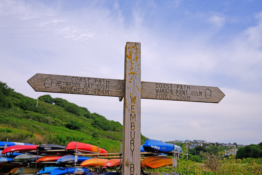
I slept on a grassy area at the back of Meadowsfoot Beach. I sat on the beach at about 5am and ate half a packet of ginger biscuits for breakfast while watching the sky lighten. It was cool and cloudy. I decided to head for Plymouth which was 18 miles away and classed as "strenuous becoming easy" to Wembury, where there was a ferry crossing to Warren Point, then it was classed as "easy" to Mount Batten, where there was a second ferry crossing into Plymouth. This was as far as I wanted to go as it was as the end of the South Devon coast section.
At Wembury beach I stopped for a large coffee and a very large bacon bap at the beach cafe. I checked the train times for Plymouth and bought a ticket using the GWR app and then carried on walking. It was then that my right knee gave out and would no longer carry my full weight, so I had to make constant use of my walking pole. That was fine on level ground but going uphill and downhill was very painful and climbing and descending steps was even worse. I took two Ibuprofen tablets and took comfort in the fact that the guide had classed this section as "easy".
 |
| Fort Bovisand ahead and Plymouth beyond |
This "easy" section turned out not to be so easy for me. There were steep, narrow, overgrown steps and paths, then a climb up to Brownhill Battery above Fort Bovisand and down again. I continued to follow the SWCP signs which then sent me down into a dense woodland where the path twisted and turned up and down before sending me down flights of slippery wooden steps that descended deeper into the woodland. My knee gave out after descending the first two flights and there were more flights to go. So instead, I eased myself back up to the start of the steps to where I had seen a "SWCP Alternative Route" sign. I continued up a short slope and came to a road that headed down towards Mount Batten. Further down the hill I was able, with the help of a local lady, to find and join path again.
By then my knee was getting really painful and as I neared the ferry at Mout Batten I spotted a bus shelter. According to the timetable there was a bus due in ten minutes that went right past the railway station.
From the bus stop I looked at the long, baking hot road where I thought the ferry point was and checked the ferry times on my iphone. I calculated that I might just get there before it sailed, or then again I might not, depending on how fast I could hobble. So I caught the bus, which then gave me a tour of the suburbs before it reached the station. With the help of a couple more Ibuprofen tablets I had a pleasant train journey home. I had also completely forgotten to take any more photos.
Later I found out that I was heading for the wrong place for the ferry anyway.
End of day 10. A little over 17 miles walked today - 5 of them hobbling along!
That's a Total of 123 miles along the East and South Devon coast and a total of 219 miles from South Haven Point.
This walk was mostly done during the hottest parts of 2022 and 2023 and I only needed my wet weather gear for 10 minutes at the end of the first day as I walked to the bus stop at Langton Maltravers. I would rather have walked in slightly cooler conditions though.
Later I decided not to carry on and walk the SWCP around the Cornish coast. I remember it well from the last time! I found that my knee was unable to cope with severe terrain anymore. I decided that my next walk would be the Tamara Coast to Coast Way, that roughly follows the river Tamar and the Devon/Cornwall border along the Tamar Valley from Plymouth to the source of the Tamar and then on to the North Cornwall coast where it meets the Devon Coast. Looking at the route it was obviously going to be an easier walk than the rugged terrain of the Cornish coast path.
back to the start of Devon in reverse
back to the top of the page
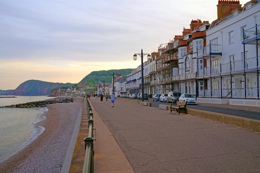
swcp.uk
All photos © Martyn Pearce
