
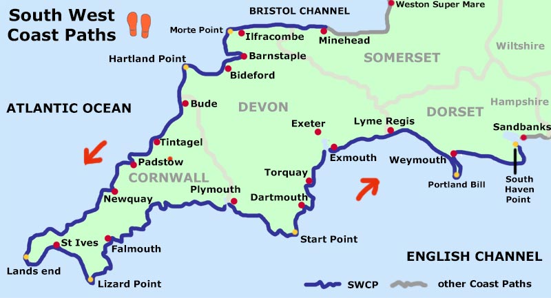
The most popular way of walking the whole South West Coast Path is from Minehead to South Haven Point. This is how most guide books are written. This page is about walking it in that direction. I have also added sections about walking the part of the England Coast Path in Somerset that is immediately before the start of the South West Coast Path and the coast path that is immediately after the finish in Dorset. I walked these more recently.
Brief accounts of my first walk along the South West Coast Path during 1999 to 2004 were written some time ago. I am now improving these accounts using the notes that I scribbled in the margins of the pages the four National Trail Guides that I used during that walk. I have finished rewriting the Minehead to Barnstaple section and will be rewriting the remaining sections soon.
ON THIS PAGE
England Coast Path:
South West Coast Path:
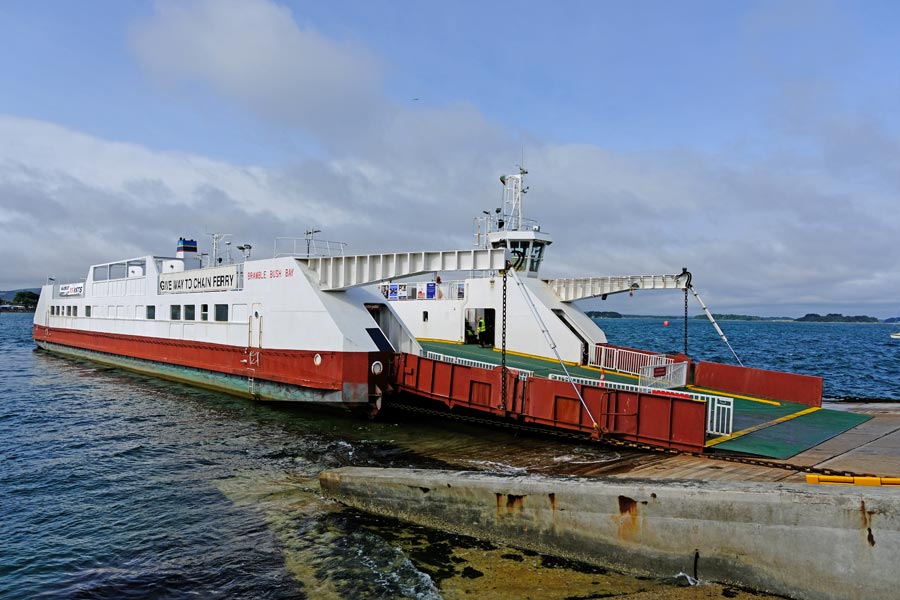
Lyme Regis to South Haven Point
Coast Path:
The England Coast Path
Weston-Super-Mare to Minehead 2025
Passing through: Brean, Berrow, Burnham-on-Sea, Highbridge, Bridgewater, Hinkley Point, Watchet and Blue Anchor.
I included this section here as it runs from the point where the River Severn ends and the Bristol Channel coast begins near Weston-Super-Mare.
I pre-booked accommodation for three nights and took a bivvy bag, sleeping bag and inflatable mat for the night that I was unable to book.
Day 1 - Weston-Super-Mare to Highbridge
 |
 |
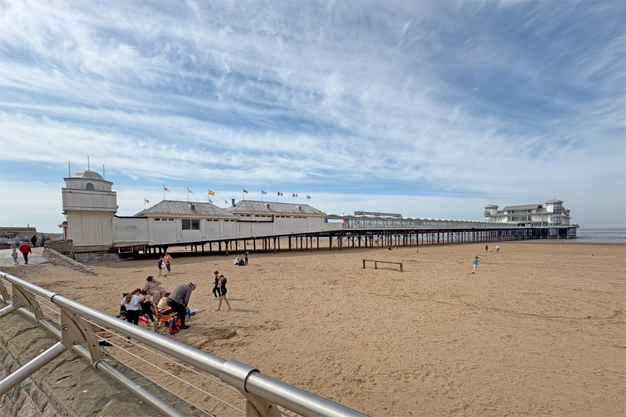
| Weston-Super-Mare | Uphill |
 |
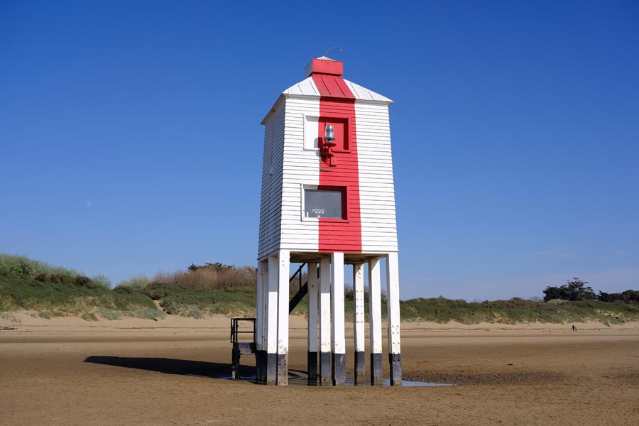 |
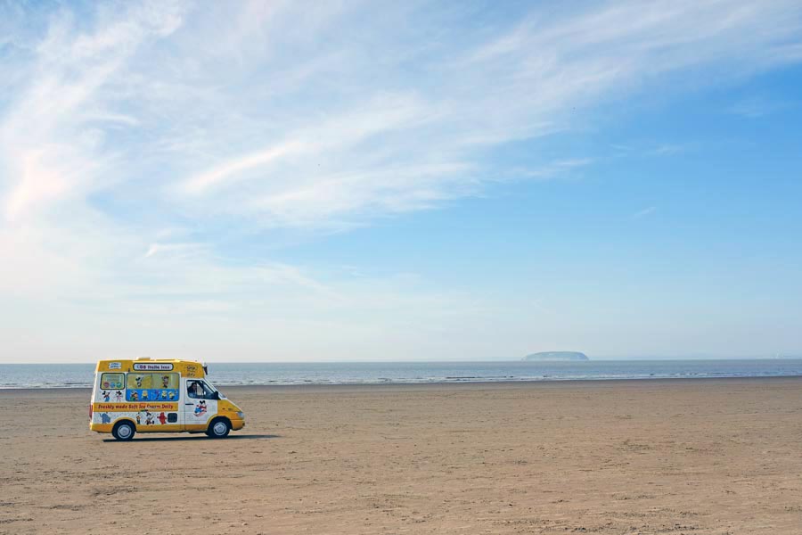
| Brean Down | Berrow, Low Lighthouse, 1832. |
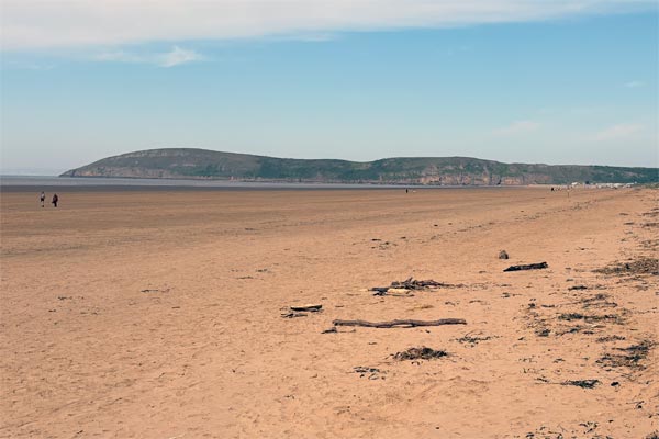
I arrived in Weston by train late morning, due to railway signalling delays. It was an April Tuesday, early in the season so there were few people about. The sun was warm but there was a cold wind blowing from the east. I kept my fleece on for most of the day. The walk along Weston beach and Berrow Flats beach was easy on the firm, damp sand. The tide was out and although it was a little misty I could make out the North Somerset coastline and the Quantock Hills on the other side of Bridgwater Bay, which was where I would be in two days. At Burnham the path leaves the beach at Bridgwater Bay. Here I stopped for a pint at the Reeds Arms, where, on the terrace and sheltered from the wind, I sat in the sun for a while, before I walking inland to Highbridge where my accommodation was.
About 12.5 miles walked today.
Day 2 - Highbridge to Bridgwater
 |
 |
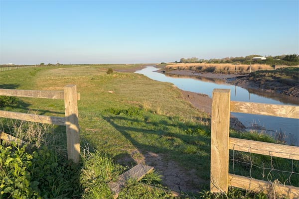
| The River Brue | The River Parrett |
Weather the same as yesterday, I walked about 2.5 miles before crossing the River Brue and walked back to Bridgwater Bay. I had to turn inland again at the mouth of the River Parrett. I looked across to Steart Point, less that half a mile away on the other side of the Parrett. In the distance I could now see the Hinkley power stations, where I intend to be tomorrow night. I continued inland on the 22 miles or so of the wildly meandering banks of the River Parrett and after about 11 miles I reached the first bridge crossing the Parrett. I continued on into Bridgwater for a mile to where my accommodation for the night was.
About 14.5 miles walked today.
Day 3 - Bridgwater to Hinkly Point
 |
 |
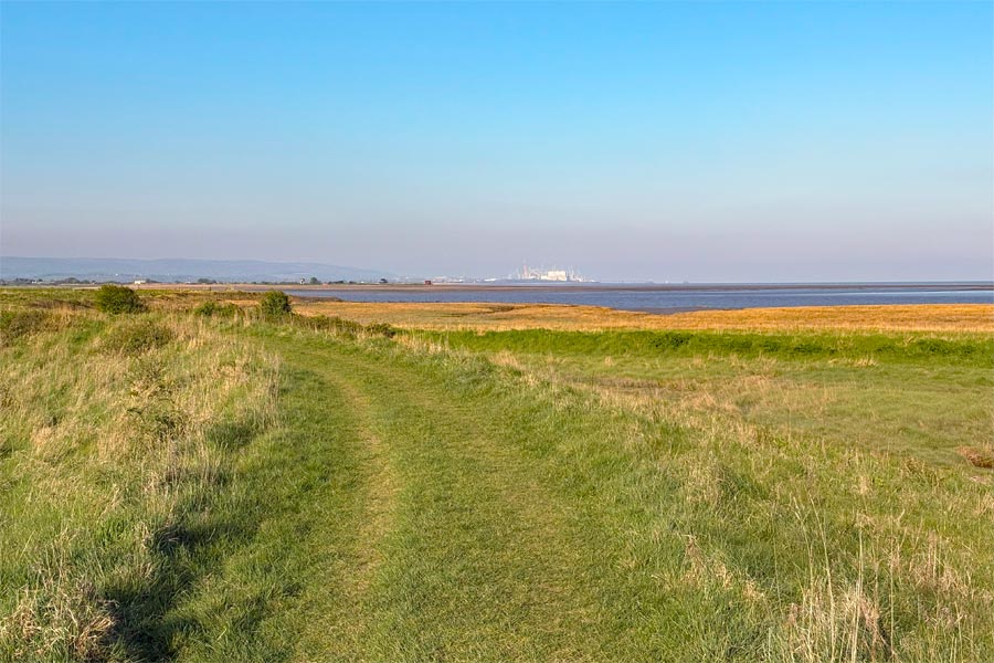
| Returning along the Parrett to the Bristol Channel | The Bristol Channel near Steart Point |
 |
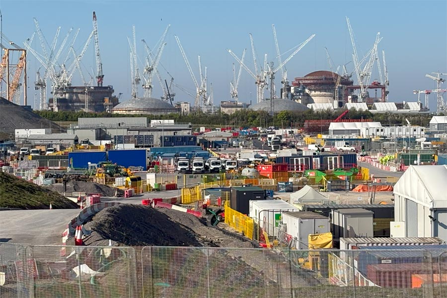 |
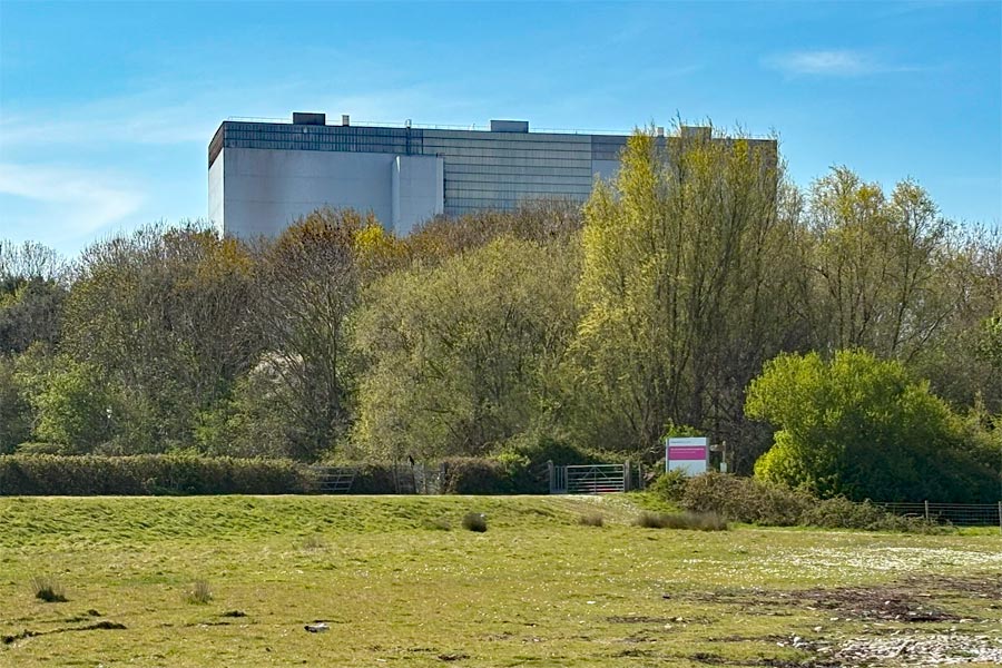
| Hinkley Point B Power Station | The Hinkley Point C site |
 |
 |
| Heaps of excavated rock and earth | Sunset over the Channel |
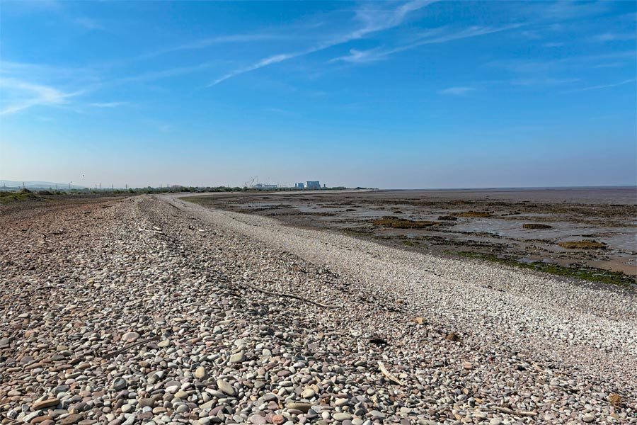
It was still sunny but there was a cold wind out in the exposed flats along the banks of the River Parrett as I returned back to Bridgwater Bay and the Bristol Channel. At the Hinkley Point nuclear power stations site I knew that the coast path was closed due to the building of Hinkley Point C. I followed the designated diversion.
I was appalled find myself directed along a very narrow strip of land with long grass hiding ridges in the very uneven ground. There was a high fence on the right hand side with a dense overgrown wood pressing up against it and a steep sided unfenced water-filled ditch dangerously close on the left hand side. I walked along the narrow path very carefully as it wasn't overlooked and there was no one else around. Then I crossed the immaculate new tarmac road to the site, with fast traffic and white buses passing backwards and forwards every few minutes carrying site workers. Soon the signage pointed me towards rough ground again but this time it was too waterlogged to walk through, so I had to walk on a narrow, uneven grass verge close to the heavy traffic before reaching the safety of a pedestrian pavement. On seeing the immaculate infrastructure for the traffic I wondered why a little more care had not been taken to provide and maintain a safe, diversion for coast path walkers.
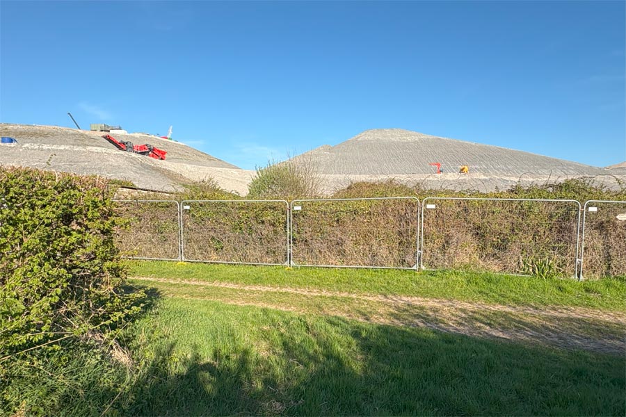
As I walked the final mile of the diversion around the construction site and back to the coast I passed the mountains of rock and earth that had been excavated, with large machines moving on them looking like tiny toys. Apparently 5.6 million cubic meters of rock and around 4 million cubic meters of earth were excavated.
As I was unable to get accommodation for this part of the walk I bivvied for the night in a sheltered spot out of the wind but overlooking Bridgewater Bay. It was a clear night with an almost full moon but the brighter stars could still be seen. It was cold. Colder than I had expected. I lay there looking at the stars and watching the passing satellites but it was too cold to sleep. So after a few uncomfortable hours I remembered that I had an emergency space-blanket in my rucksack. With this wrapped around me inside my sleeping bag I got warm enough to sleep.
About 18 miles walked today.
Day 4 - Hinkley Point to Watchet
 |
 |
 |
 |
 |
 |
| Approaching Watchet | Watchet Harbour |
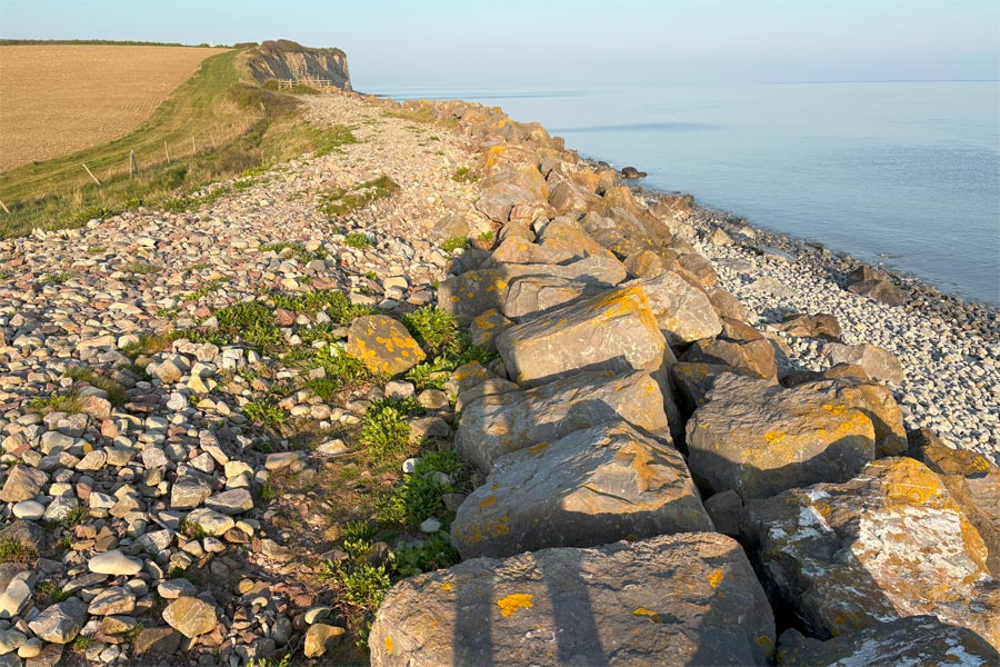
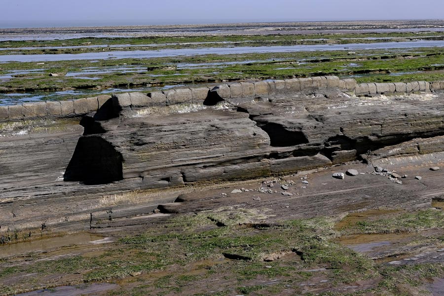
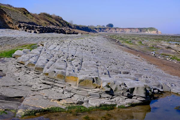
This stretch of coast had some very interesting natural features, rock pools and other rock formations on the beaches. The coast path is along the beach at St Audrie's Bay and Hellwell Bay so it cannot be used during high tides. There is no alternative safe route for walkers. The tide was low when I walked through. Some ledges and layers of rock have slippery seaweed attached. Some of the layers look as if they are remnants of some huge man-made road of giant cobbles.
About 9 miles walked.
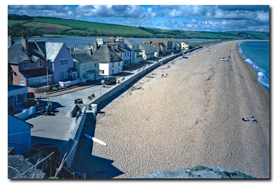
Day 5 - Watchet to Minehead
 |
 |
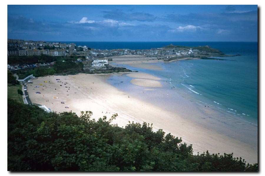
| Approaching Minehead | The start of the SWCP |
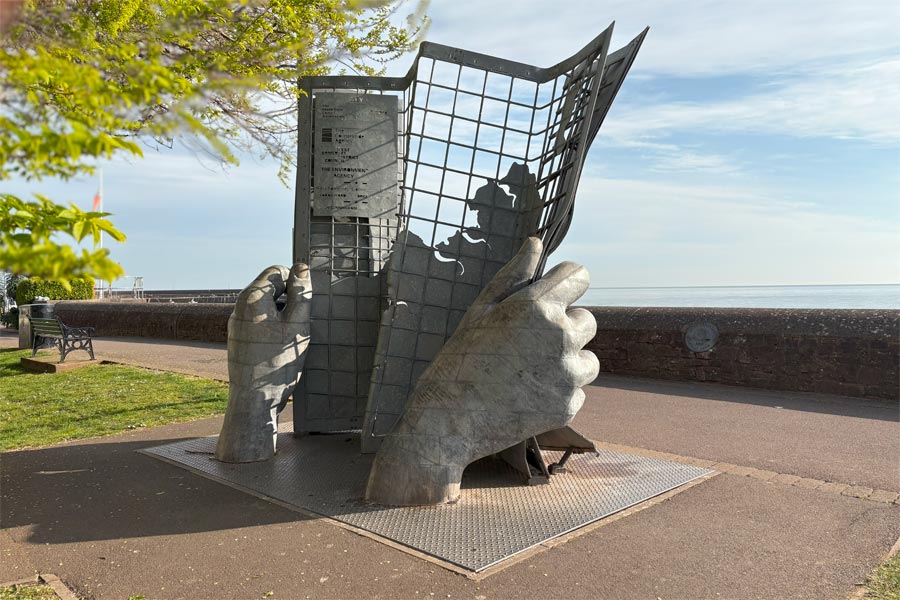
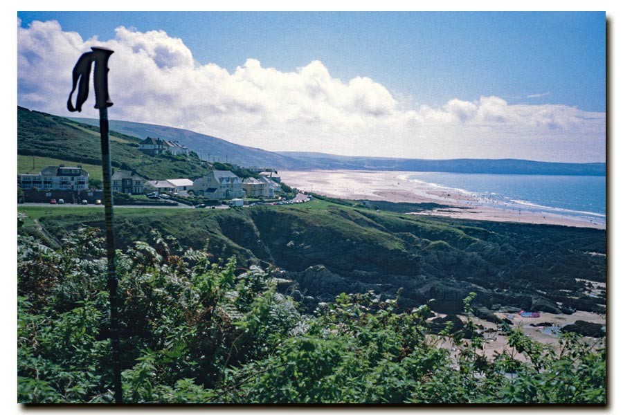
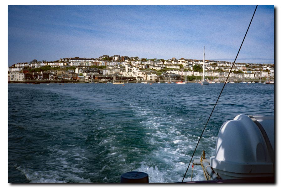
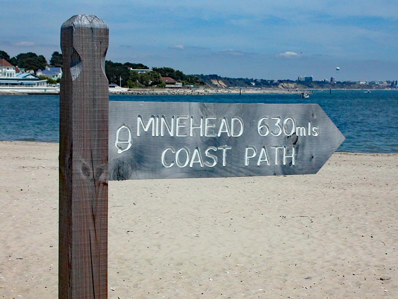
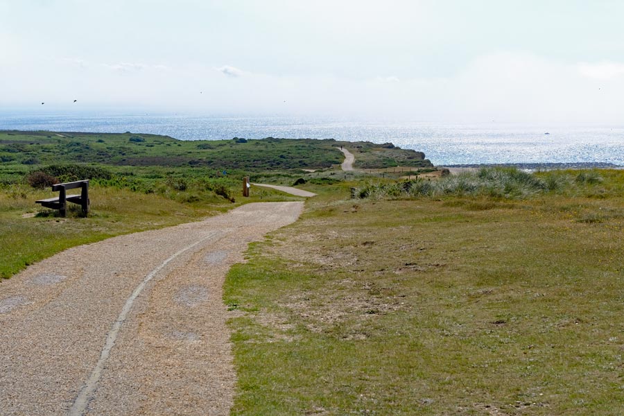
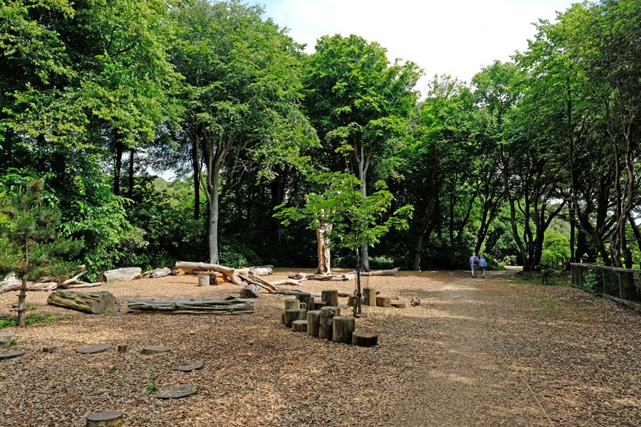
It was a half-day walk into Minehead. The hills and cliffs ended just before Blue Anchor and the rest of the walk was easy going along the shore. The clouds rolled in as I walked through Minehead and arrived at the metal sculpture denoting the start of the South West Coast Path. When I was last here, in 1999, there was only a small brown sign where the path used to start saying, incorrectly, "Coast Path to Poole 500 miles".
About 8 miles walked today.
A total of about 60 miles in three days and two half days.
back to Weston Super Mare start
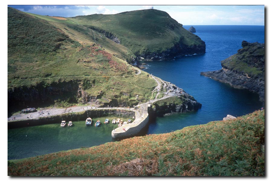
The SWCP start
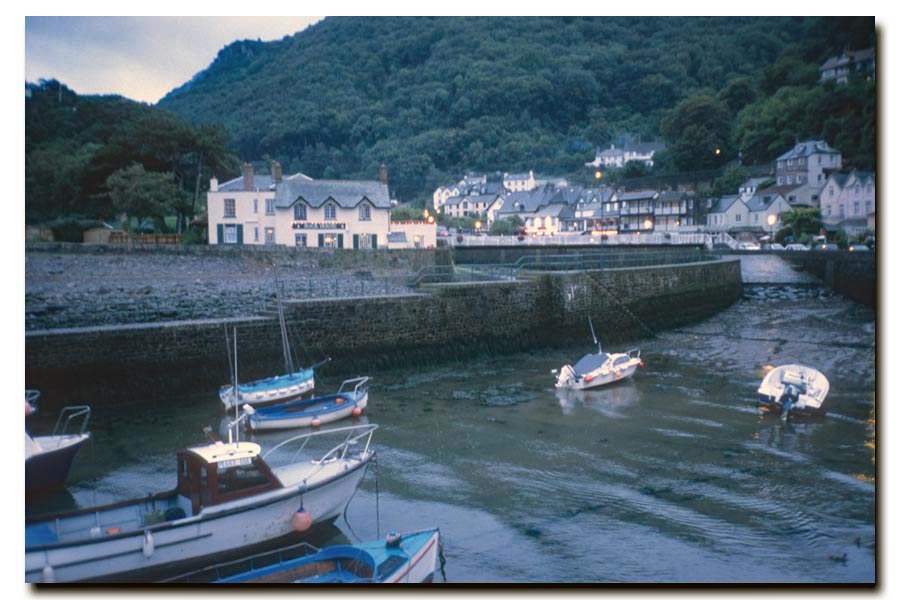
Minehead to Barnstaple 1999
Passing through: Porlock, Lynmouth, Lynton, Combe Martin, Ilfracombe, Morteho, Woolacombe, Croyde, Saunton, and Braunton.
I took a tent, a sleeping bag and an inflatable sleeping mattress to give me more flexibility over where to stop if I could not find or chose not to stay in accommodation overnight.
Most of the photos for this walk were taken on a small film camera. Later I realised that I didn't take enough photos.
 |
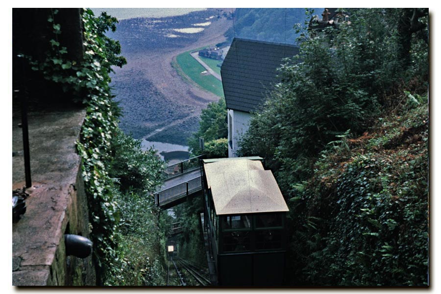 |
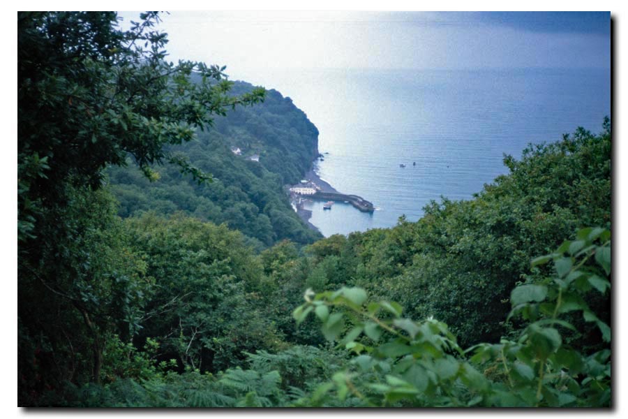
| Lynmouth, late afternoon. | Lynmouth to Lynton Cliff Railway |
The next day began with a long trek through the woods that lined the top of the cliffs, so I could hear the sea but only glimpse the view now and then. It began to get misty and then start to rain and then my waterproof jacket started to get wet inside. After six or seven miles the woods thinned out and the view of the coast returned. At Lynmouth Bay I detoured inland to the White Horse Inn for lunch. It was now sunny. As I walked on again it started to rain and by the time I got to Lynmouth I was soaked; the waterproofing on my jacket had failed. I booked into the Rock House Hotel to get dried out and went to look for a replacement jacket. There was only one suitable shop and it only stocked 'quality' walking clothes. The only jacket that I could get was heavier and more expensive than I wanted. I had just blown most of my budget on a hotel room and a new jacket!
End of day 2. About 10 miles walked today.
 |
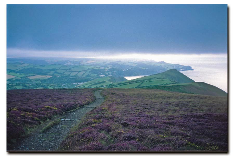 |
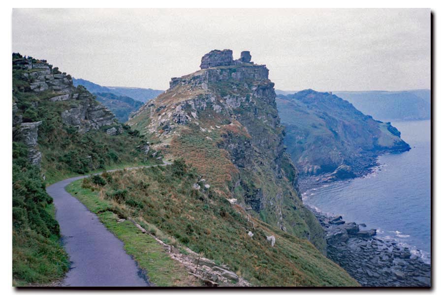
| Castle Rock just beyond Lynmouth. | On the Great Hangman above Combe Martin. |
After a good night's sleep I put on my dry clothes, had a good breakfast and walked as far as the Lynmouth to Lynton Cliff Railway which I chose (as suggested by my guidebook) instead of a climb up the cliff. I walked past Castle Rock and into the valley of the rocks. It was warm and humid. The path turned inland to a bridge that crosses the River Heddon but I continued inland for another half mile reach to The Hunters Inn where I was looking forward to a pint and some lunch. It was lunchtime but it was closed. Back on the coast I was beginning to find it hard going. There had been a few showers and the narrow sunken path down to Combe Martin was very muddy. I walked on through the village to my campsite for the night at Newberry Farm. I arrived at about 20:00.
End of day 3. About 15 miles walked today.
End of day 4. Only about 6 miles walked today. No photos were taken.
 |
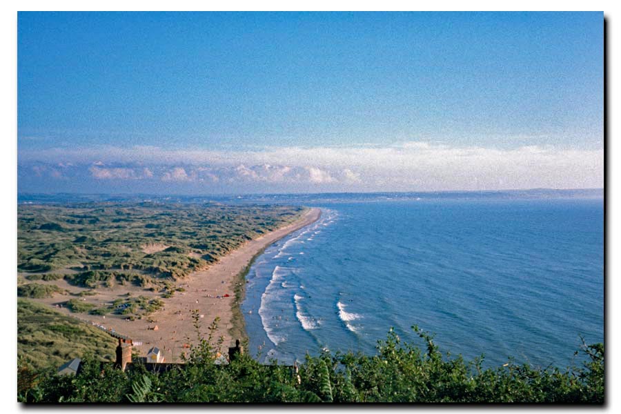 |
| Morte Bay ahead. | Saunton Sands and Braunton Burrows. |
End of day 5. About 19 miles walked today.
Next day I walked to Barnstaple along the banks of the River Taw, had a wander around the town as I had lived there for a time when I was a CEGB apprentice. I had a pint in the Three Tuns for old times sake then caught a train home.
End of day 5. About 8 miles walked today.
Minehead to Barnstaple: About 67 miles walked in total.
Best:
Arriving at Ilfracombe at 1pm on Carnival day and deciding to stop and chill out.
Worst:
Miles of damp woods with no coastal views between Porlock and Foreland Point. Nice if you love woodlands though.
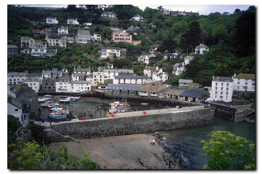
SWCP Barnstaple to Newquay 2000
Passing through: Instow, Bideford, Apledore, Westward Ho!, Clovelly, Hartland Quay, Bude, Widemouth Bay, Cracklinton Haven, Boscastle, Tintagel, Port Gaverne, Port Isaac, Port Quin, Polzealth, Trebetherick, Rock, (ferry).
When walking from Minehead to Barnstable last year I overloaded myself with camping gear, so for this year I pre-booked my accommodation in advance. My rucksack was much lighter and had nothing strapped to it.
 |
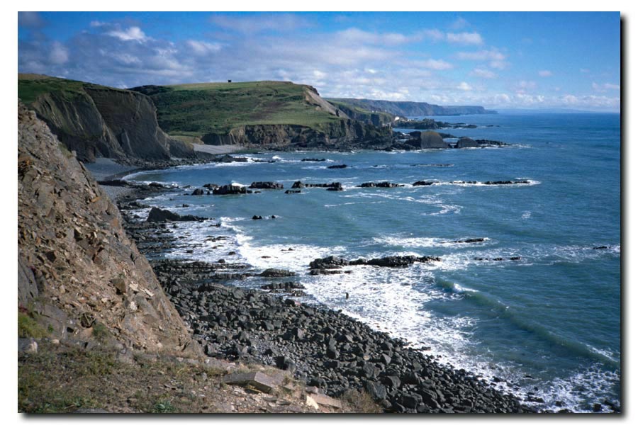 |
| Clovelly harbour through the trees. | Cliffs near Hartland. |
 |
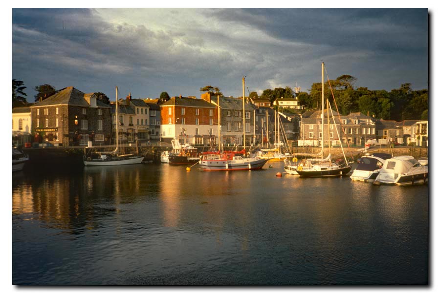 |
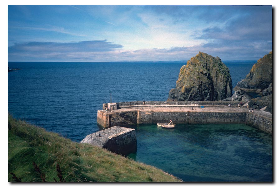
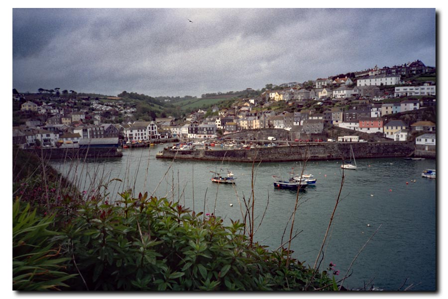
| Boscastle Harbour. | Padstow Harbour. |
Barnstaple to Newquay. About 125 miles walked. 7 days.
Total so far 192 miles. 12 days.
I ended this section at Newquay because it had a railway station. Back to work on Monday.
Notable: Mrs Dann's B&B.
After a hard 20 mile walk from Tintagel, my B&B in Padstow town centre took some time to find. There was a notice on the door: "Ring the bell and wait at least two minutes. Don't ring again. My feet won't get there any quicker". Another notice said: "No en-suite rooms. No TV in the rooms. No single rooms - you will have to pay extra".
When I told Mrs Dann that I wanted to leave at 7 am the next morning, she told me that I was "leaving too early for breakfast" and that I "still had to pay full price". I asked about a packed lunch instead but she said "I don't do packed lunches". I was worn out and needed to rest, so I paid up.
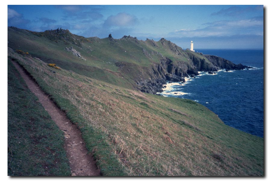
SWCP Newquay to Falmouth 2001
Passing through: Perranporth, St Agnes, Porthtowan, Portreath, Hayle, Carbis Bay, St Ives, Sennen Cove, Porthcurno, Mousehole, Newlyn, Penzance, Marazion, Porthleven, Mullion Cove, Lizard Point, Cadgwith, Coverack, Helford, (ferry).
I pre-booked my accommodation for this section.
 |
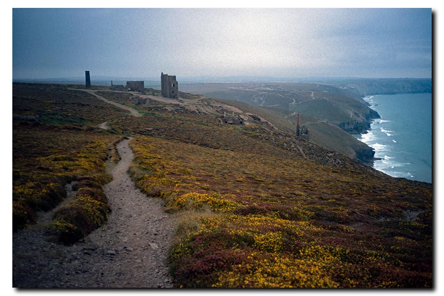 |
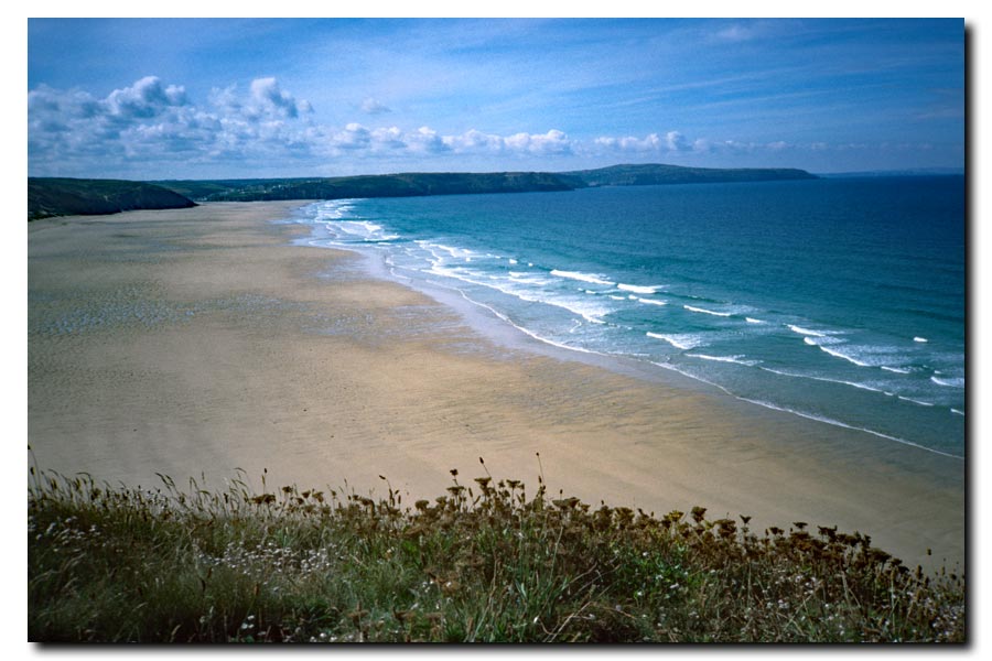
| Perran Beach, Perranporth. | Ruins of tin mines. |
 |
 |
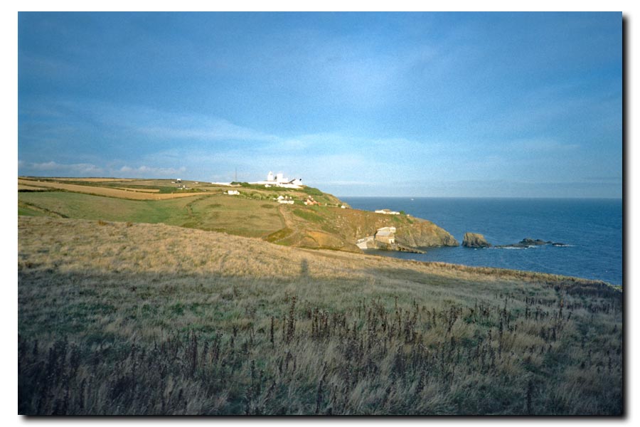
| Approaching St Ives. | Lands End. |
 |
 |
| Leaving Mullion Harbour. | Approaching Lizard Point. |
Newquay to Falmouth: About 150 miles walked. 10 days.
Total so far: 341 miles. 22 days.
Best: My cosy accommodation in a little cabin next to a stream at Lamorna Cove.
Bad: The new Lands End Experience. A noisy, unattractive collection of down-market amusements and concessions completely out-of-place. I spent 5 minutes there and walked on. (It may have improved since then. ?)
Worst ever: I stopped for the night at Coverack and went into the bar of the Paris Hotel. The terrible pictures of the destruction of the Twin Towers were on the television. It was September 11th.
Next day, shortly after setting out, I decided to abandon my walk. I couldn't get those pictures out of my head. I had intended to reach Plymouth but I knew that I wouldn't enjoy the walk now. I walked straight to Falmouth and took the next train home.
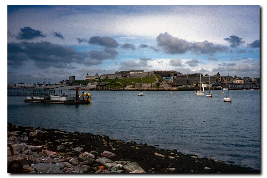
SWCP Falmouth to Plymouth 2002
Passing through: (ferry), St Mawes, (ferry), Mevagissey, St Austel, Par, Fowey, (ferry), Polperro, Looe, Portwrinkle, Cremyll, (ferry).
I pre-booked my accommodation again for this section.
 |
 |
| Falmouth to St Mawes ferry. | Porthcurnick Beach from Pednaven. |
 |
 |
| Mevagissey. | Lantic Bay. |
 |
 |
| Polperro. | Cremyll ferry to Plymouth. |
Falmouth to Plymouth: About 74 miles walked. 5 days.
Total so far: 415 miles. 27 days.
Best: Meeting up with Bob Williams, a fellow lone walker, and chatting in the pub several evenings at stops along the way.
Worst: Walking the dusty paths enclosed by high rusty fences weaving between seemingly abandoned buildings at Par.
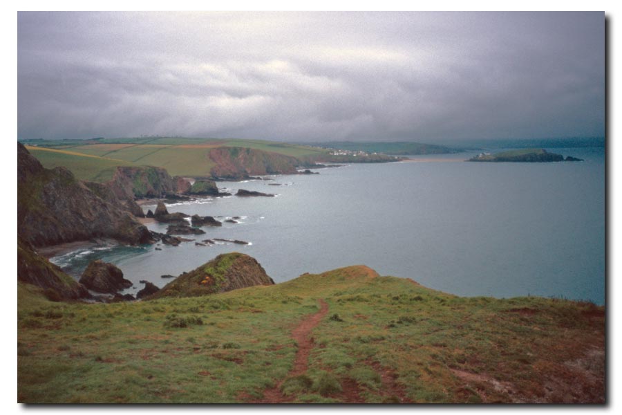
SWCP Plymouth to Lyme Regis 2003
Passing through: (ferry), Mountbatten, Wembury, (ferry), (wading*), Bigbury on Sea, Salcombe, Torcross, Stoke Fleming, Dartmouth, (ferry), Kingswear, Brixham, Goorington, Paignton, Torquay, Teignmouth, Dawlish, Starcross, (ferry), Exmouth, Budleigh Salterton, Sidmouth, Beer and Seaton.
* Wading the River Erme at low tide only.
I decided not to pre-book any accommodation for this section. During the last few sections there were several times when I had to keep going to get to my accommodation and other times when I wanted to keep going but had to stop because I had got there. This time I took a light sleeping bag and a bivvy bag in case I could not find anywhere to stay, or did not want to sleep indoors.
 |
 |
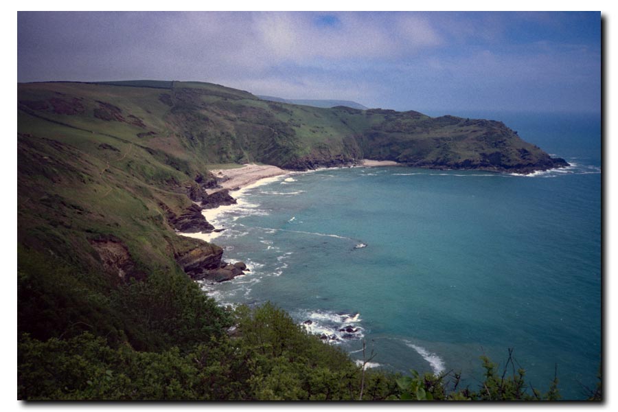
| Aproaching Bigbury-on-Sea. | Aproaching Start Point. |
 |
 |
| Torcross. | Teignmouth Ferry. |
 |
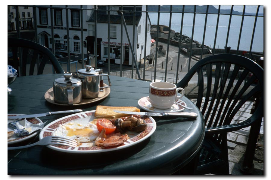 |
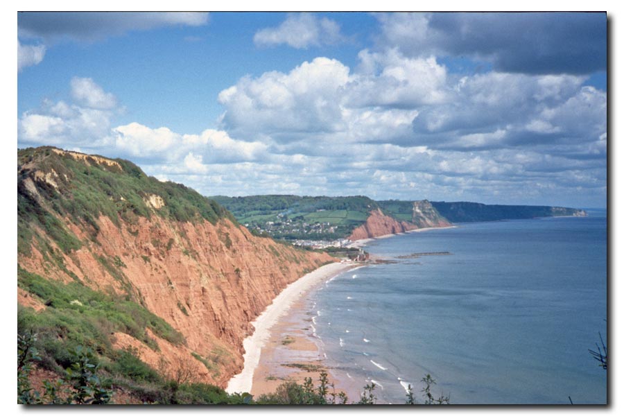
| The Jurassic Coast. | Breakfast in Lyme Regis. |
Plymouth to Lyme Regis: About 122 miles walked. 10 days.
Total so far: 537 miles. 37 days.
Bests: Sleeping out under the stars and having breakfast next day in Lyme Regis.
Worst: Having to wade thigh deep across the Erme Estuary in the dark at low tide, not reaching the opposite bank in the right place and climbing a steep muddy stinging nettled bank with no boots or socks on.
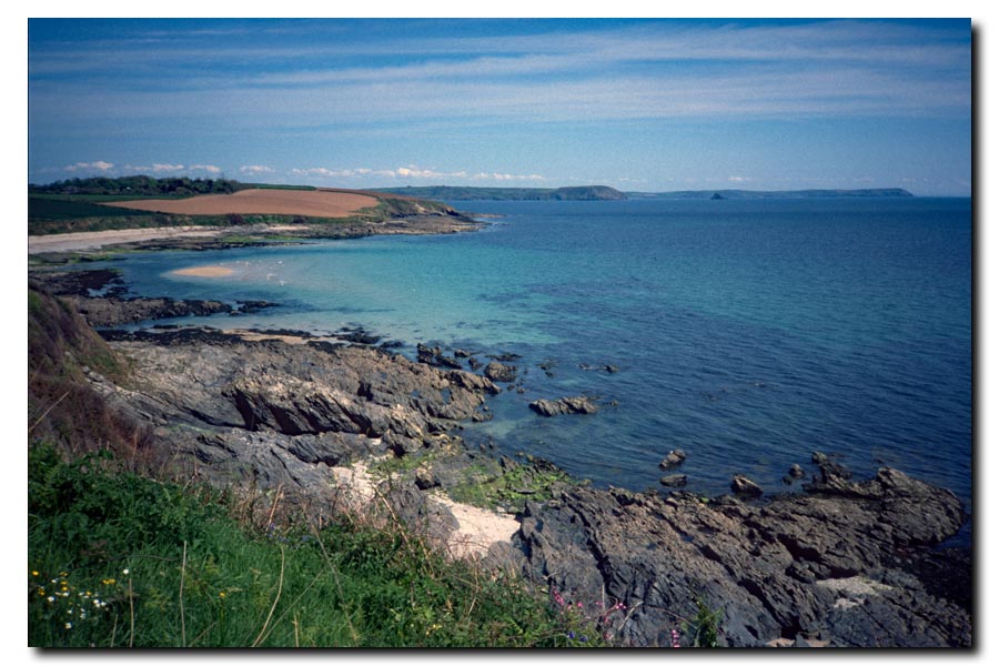
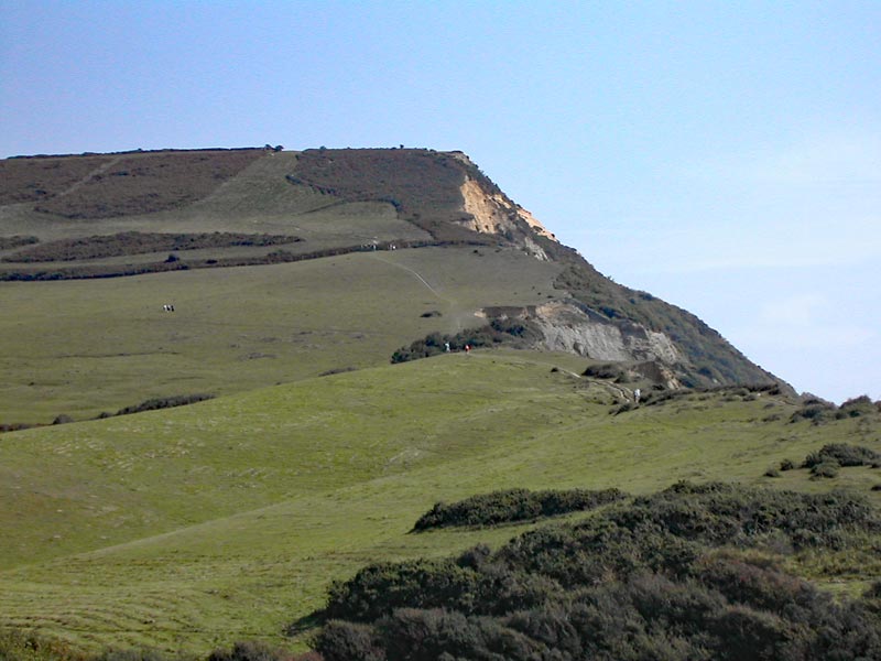
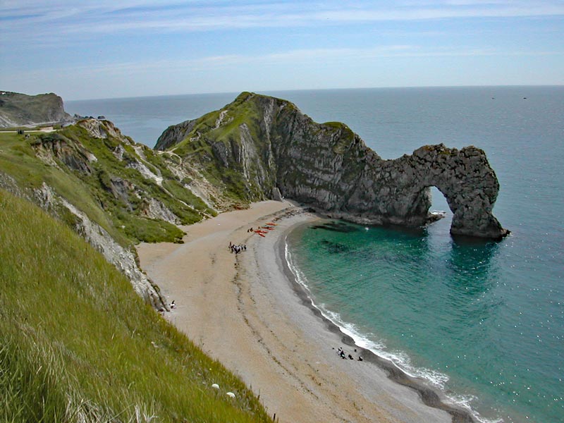
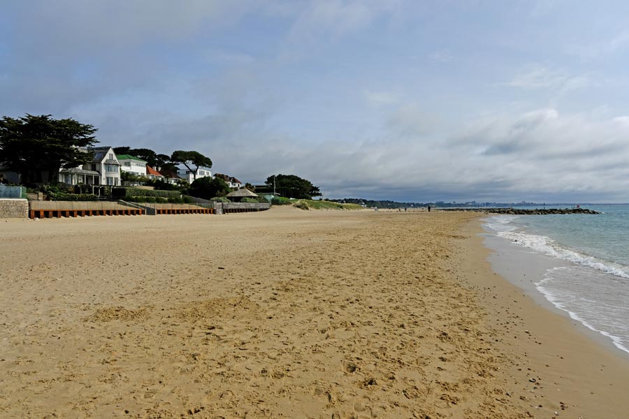
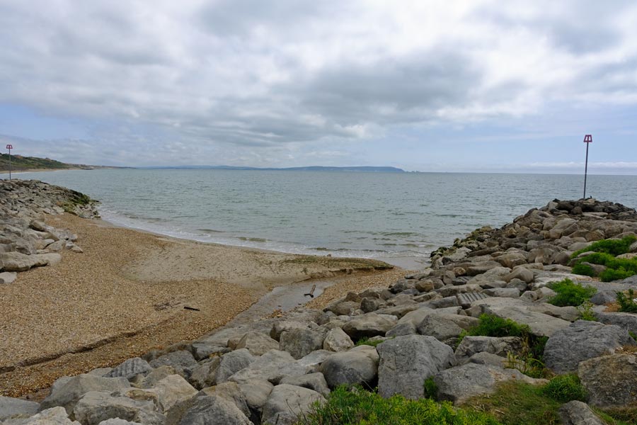
SWCP Lyme Regis to South Haven Point 2004
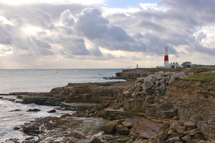
Passing through: Charmouth, Seatown, West Bay, Abbotsbury, Weymouth, Osmington Mills, Durdle Dor, Swanage and Studland.
I didn't need accommodation for this section because I had retired and moved to West Dorset at the end of 2003. So I was able to take buses to and from the start and finish points.
The photographs from now on were taken on a digital camera.
 |
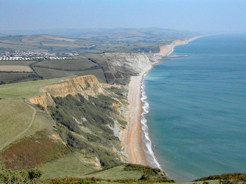 |
| Approaching Golden Cap. | West Bay. |
 |
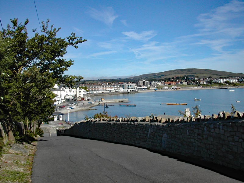 |
| Durdle Dor. | Swanage. |
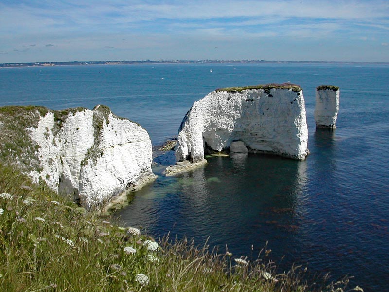 |
 |
| Old Harry Rocks. | South Haven Point. |
Lyme Regis to South Haven Point: About 79 miles walked. 5 days.
Best: Everything.
Worst: Nothing.
Total: The SWCP from Minehead to South Haven Point: 613 miles. 42 days.
Only 613 miles? Yes. The Isle of Portland was not part of the SWCP when I started out, but it was by the time I reached the end, so I walked it later and added 17 miles and 1 day to my totals.
Final total: 630 miles. 43 days.
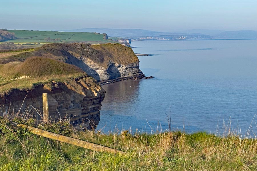
Portland
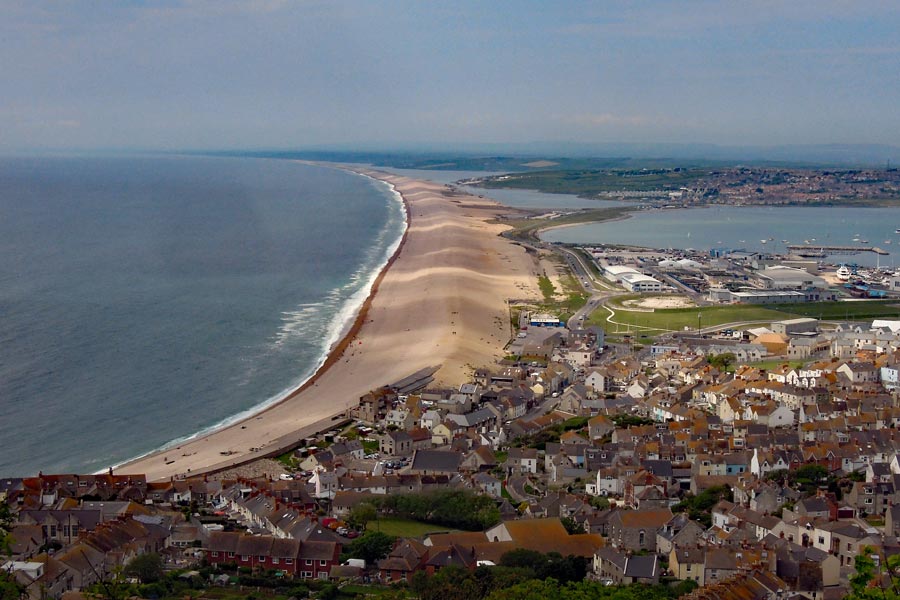 |
 |
| Chesil Beach and causway. | Portland Bill. |
Coast Path
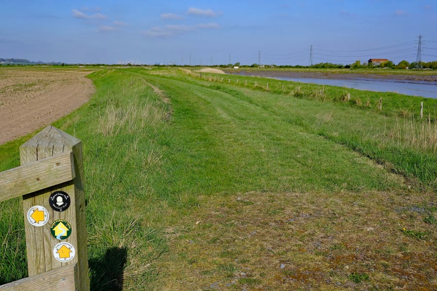
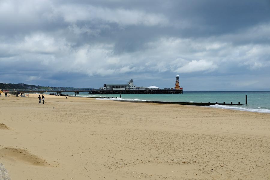
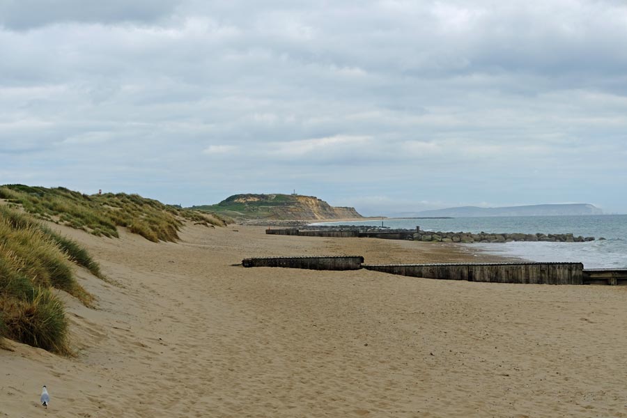
Sandbanks to Highcliffe
Passing through: Westborne, Bornemouth, Boscombe, Southbourne, Hengistbury Head, Christchurch, Mudeford and Highcliffe.
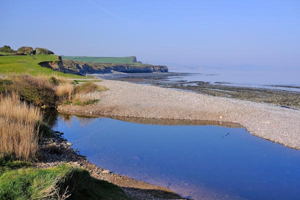
I included this walk here as it completes the remainder of the Dorset coast that the SWCP does not cover. It runs from the point where the ferry from South Haven Point lands at Sandbanks and ends at Chewton Bunny on the border between Dorset and Hampshire.
This section is easy walking and can be completed in one day but I walked it in two half days because of the traveling time to and from the start and finish points from where I was staying at the time.
Day 1 - Sandbanks to Southbourne.
 |
 |
| The ferry at Sandbanks | Sandbanks beach |
 |
 |
| Bournemouth | Hengistbury Head. |
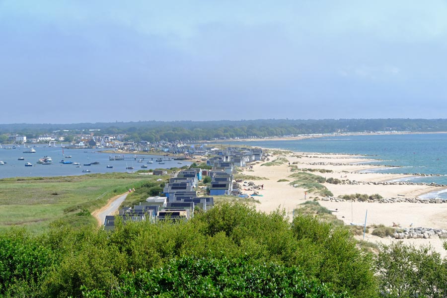
From my campsite near Corfe it took two buses to get to Sandbanks. I alighted the second bus, the number 50, on the Sandbanks side of the ferry. There is no way to get to the adjacent beach straight away as there is no promenade here because the posh houses extend to the beach. The easy way is to walk on the pavement of the B3369 for just over a mile to where the promenade starts. I chose to take an alley between the houses and walk on the damp sand at the water's edge for a couple of miles before joining the promenade. It was warm with a few clouds but there was a brisk wind blowing from the west. By the time I got to Bournemouth, the clouds were thickening and I had to roll my sleeves down and zip my fleece up. I walked on past Boscombe and it's Pier and at Southbourne, with Hengistbury Head just ahead, I turned inland to the bus stop for the first of three bus rides back to my campsite.
About 9.5 miles walked today.
Day 2 - Southbourne to Highcliffe.
 |
 |
| Hengistbury Head Nature Reserve | Hengistbury Head view |
 |
 |
| Mudeford Ferry | Mudeford |
 |
 |
| Highcliffe Castle grounds walk | The Hampshire border at Chewton Bunny |
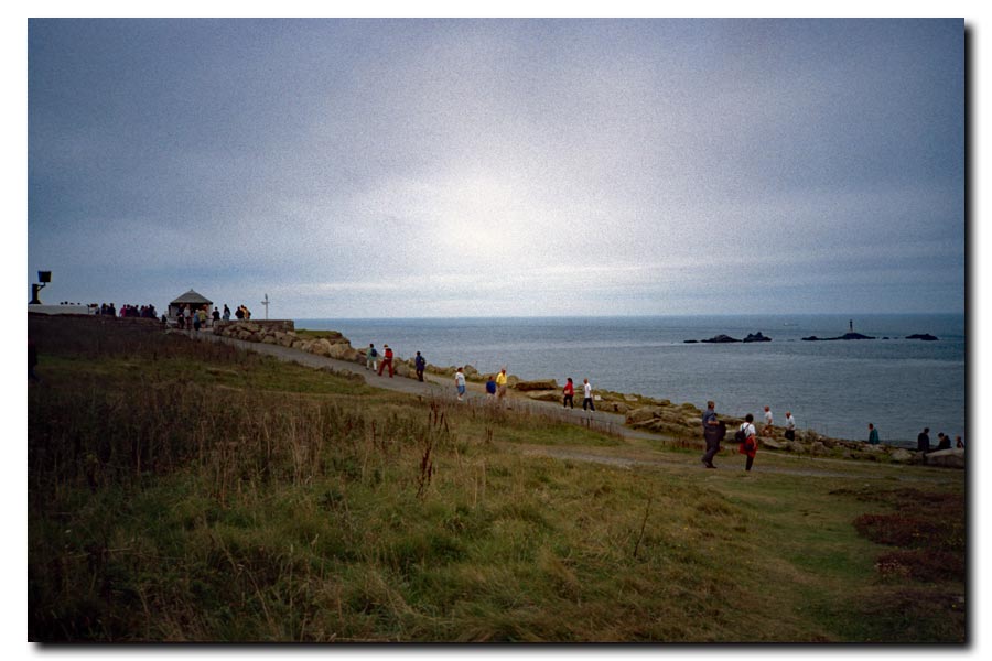
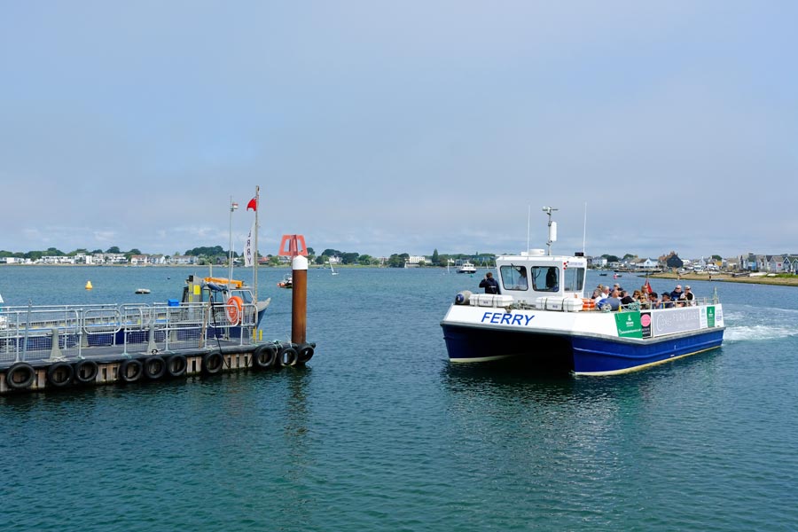
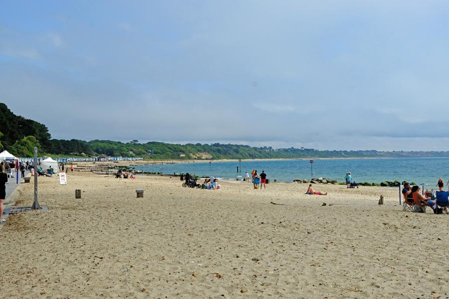
It took two buses and three hours to get back to Southbourne. It was sunny and very warm. I walked back to the coast and through the nature reserve to the top of Hengisbury Head. From the top I could see the beach huts, Christchurch harbour on the left and Mudeford beyond. Descending the hill and walking on the harbour side of the beach huts I took the ferry to Mudeford. After a walk along the beach at Mudeford the path ascends the cliff and passes through the grounds of Highcliffe Castle before dropping down again to the beach at Highcliffe. At the end of the beach, at Chewton Bunny, Walkford brook enters the sea. This is the border between Dorset and Hampshire.
The path then turns inland to follow Walkford Brook as far as the A227 and shortly afterwards drops back down to continue along the top of the cliffs at Barton on Sea. From here I walked to New Milton station and caught a train to Wareham then a short bus ride back to Corfe. Much quicker.
About 8.5 miles walked today.
About 18 miles in total.
secp.uk
All photos © Martyn Pearce